Cloudy Bay, South Bruny National Park
Jess Bonde
Access your favourites here
You have a trip stored, would you like to save it?
Take time-out on the Tasmanian shore: smell the seaweed and salty air; rub the coarse sand between your fingers; tune-in to the rhythm of breaking waves; walk, swim, tinker and explore. From wild ocean frontiers to lichen-dappled boulders, gemstones in the sand and flecks of rockpool gold, the island’s coastlines tell some ripping yarns.
Cosy Corner, Bay of Fires Conservation Area
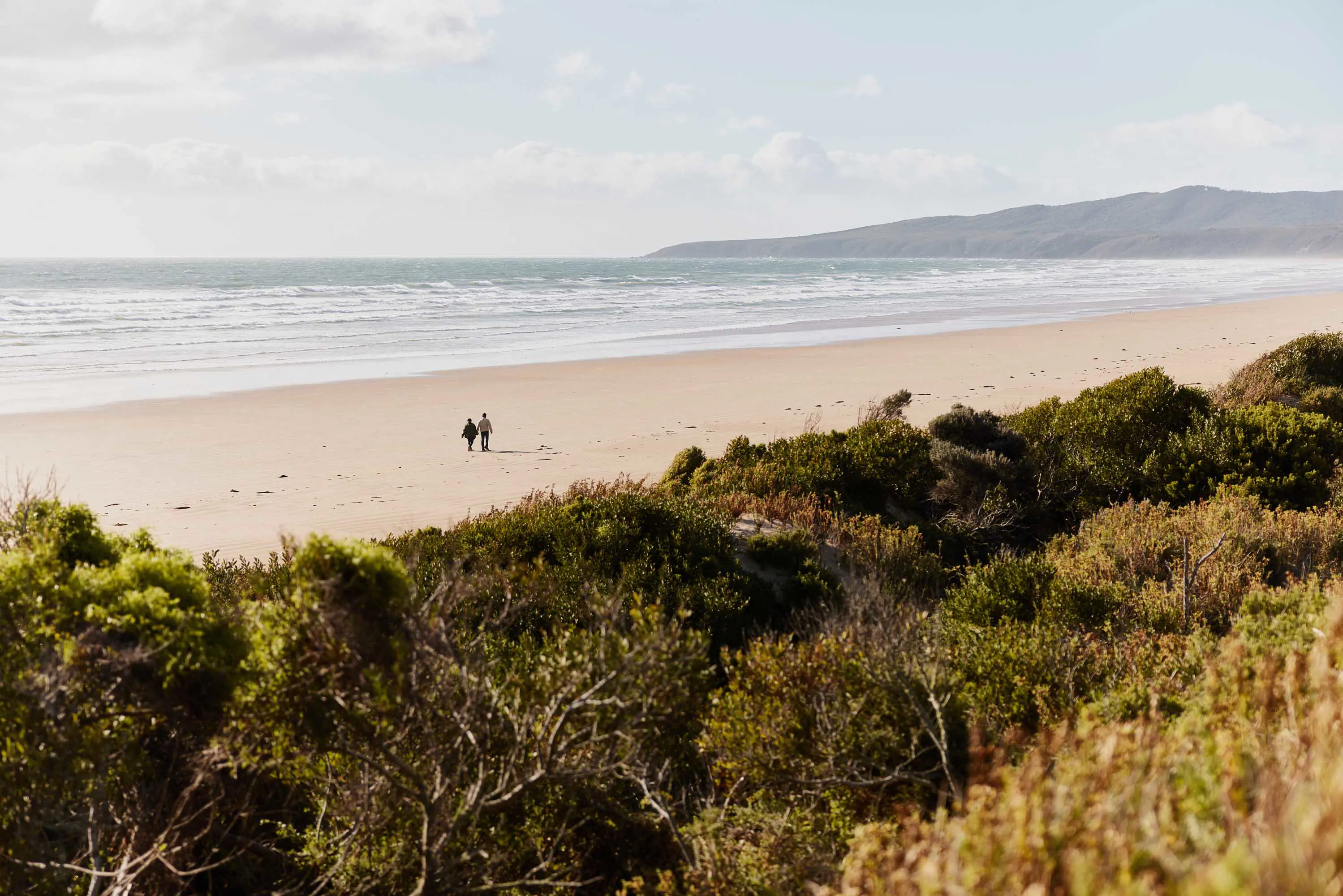
Whether it’s a broad ocean expanse or a serene sandy curve, Tasmania's beaches are less bikini, more beanie. You can usually find a stretch of shoreline here where you can sit and contemplate without too many beach bods around. Focus on the little things: a perfect shell, a twist of kelp, a smooth shard of beach glass...then swipe up to the horizon for the big-picture perspective. Clarity comes easily on Tasmania's beaches.
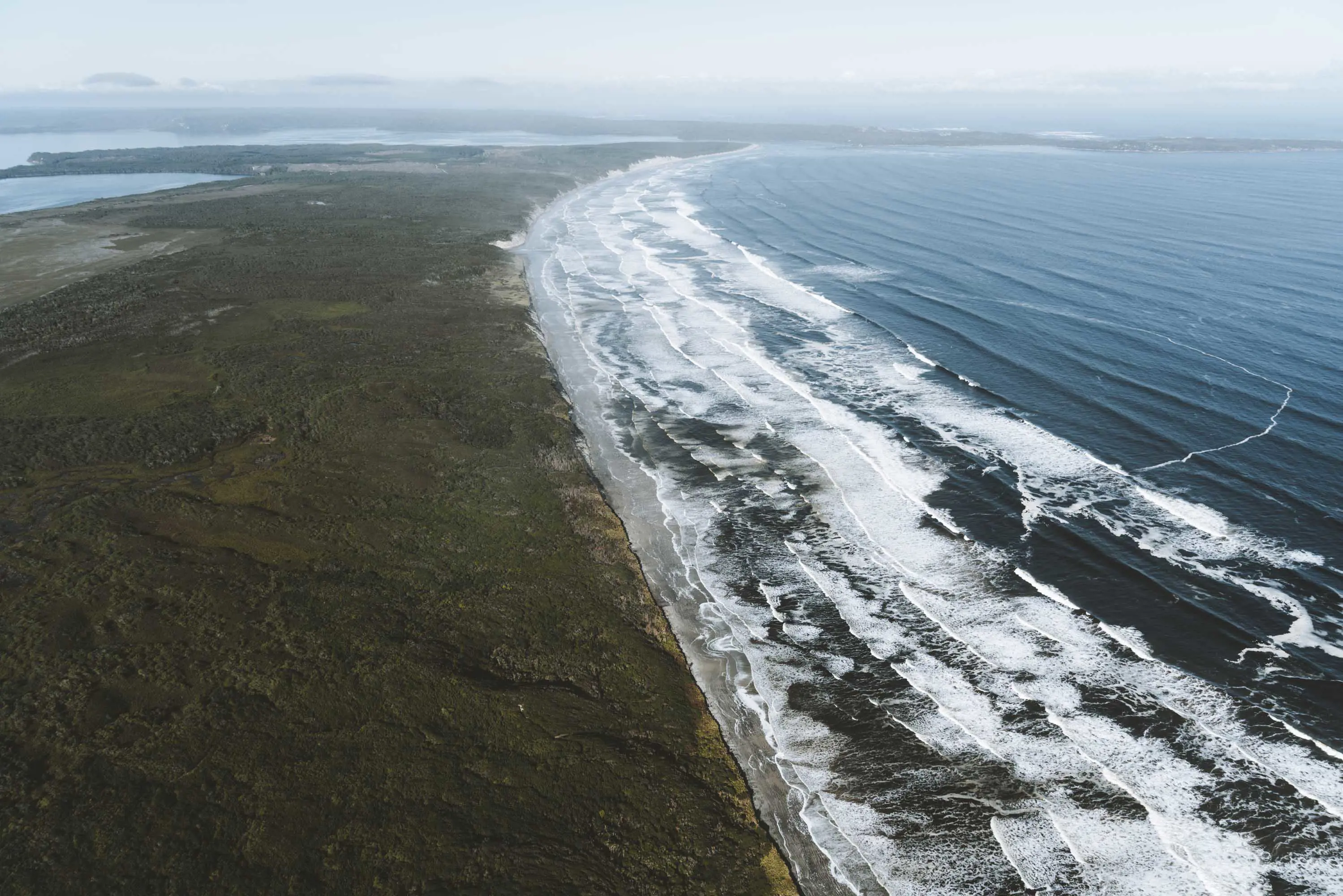
Tasmania's longest beach is a short drive from Strahan on the west coast. Ocean Beach delivers the ultimate Southern Ocean encounter — 40km of windswept sand with nothing between you and Argentina but shipwrecks and sea monsters.
For a slightly less epic rough-and-tumble in the surf, Redbill Beach at Bicheno has the east coast's most reliable and accessible waves. There's also Diamond lsland isthmus to wade across, dunes for the kids to tumble down, and some good food-and-drink options just up the road.
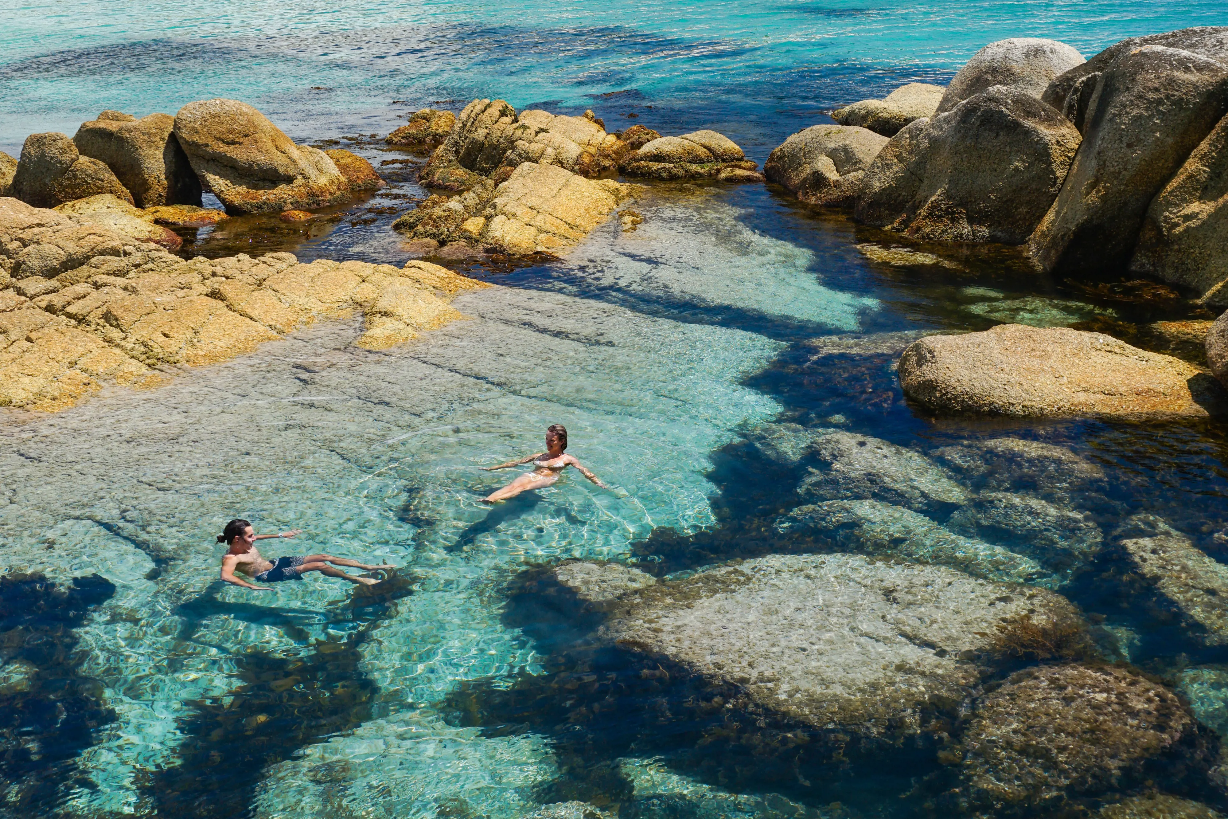
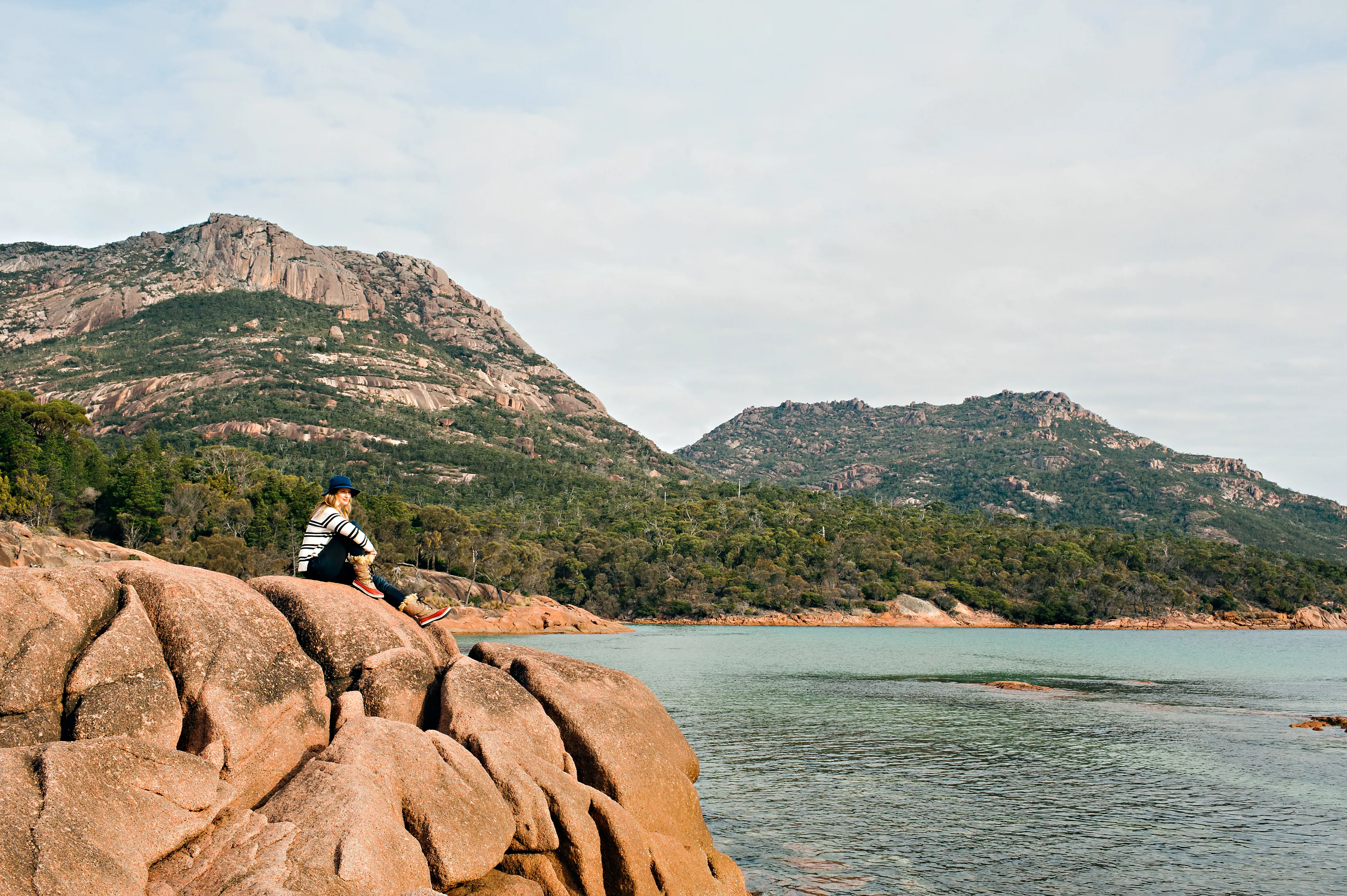
Not far south within Freycinet National Park is the picture-perfect arc of Honeymoon Bay, bookended by slabs of granite made for climbing, picnicking, napping…grab the snorkel and goggles and drift along the bay’s rocky fringe, floating among seaweed and sea creatures.
Continuing south, discover Crescent Bay within Tasman National Park — a lesser-known goblet of golden sand that feels blissfully detached from popular Port Arthur Historic Site just around the headland. Trek to the top of 174m Mt Brown en route for a good look around...or don't. Exertion optional.
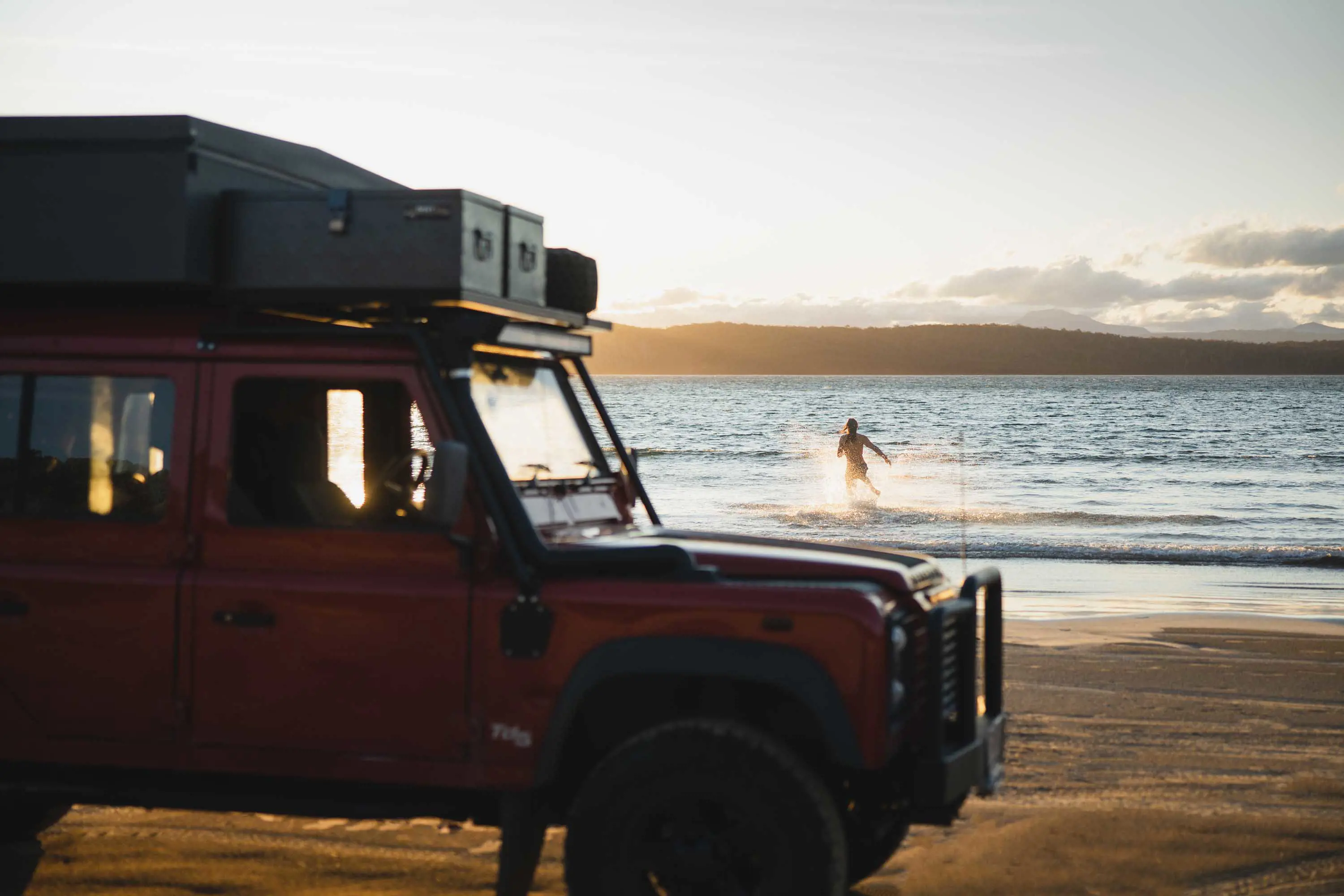
Closer to Hobart, jump in for a swim at Kingston Beach, Seven Mile Beach or Cremorne. Clifton Beach has the closest surf to the city, or ferry over to Bruny Island and check the swell at remote Cloudy Bay within South Bruny National Park.
In the north, where Kanamaluka / River Tamar meets the sea, curvy Greens Beach sits alongside Narawntapu National Park — itself home to long-and-lean Bakers Beach (and more than a few wallabies). Across the estuary near Low Head is Lagoon Beach, a west-facing strip of sand with mesmerising sunsets.
If Tasmania was Greece, beautiful Boat Harbour Beach on the north-west coast would be backed by whitewashed houses and cobblestone alleys, with ouzo joints lining the harbour. Lucky for you, this uncrowded little swimming cove is 15,000km from Santorini. BYO ouzo.
Cloudy Bay, South Bruny National Park
Bakers Beach, Narawntapu National Park
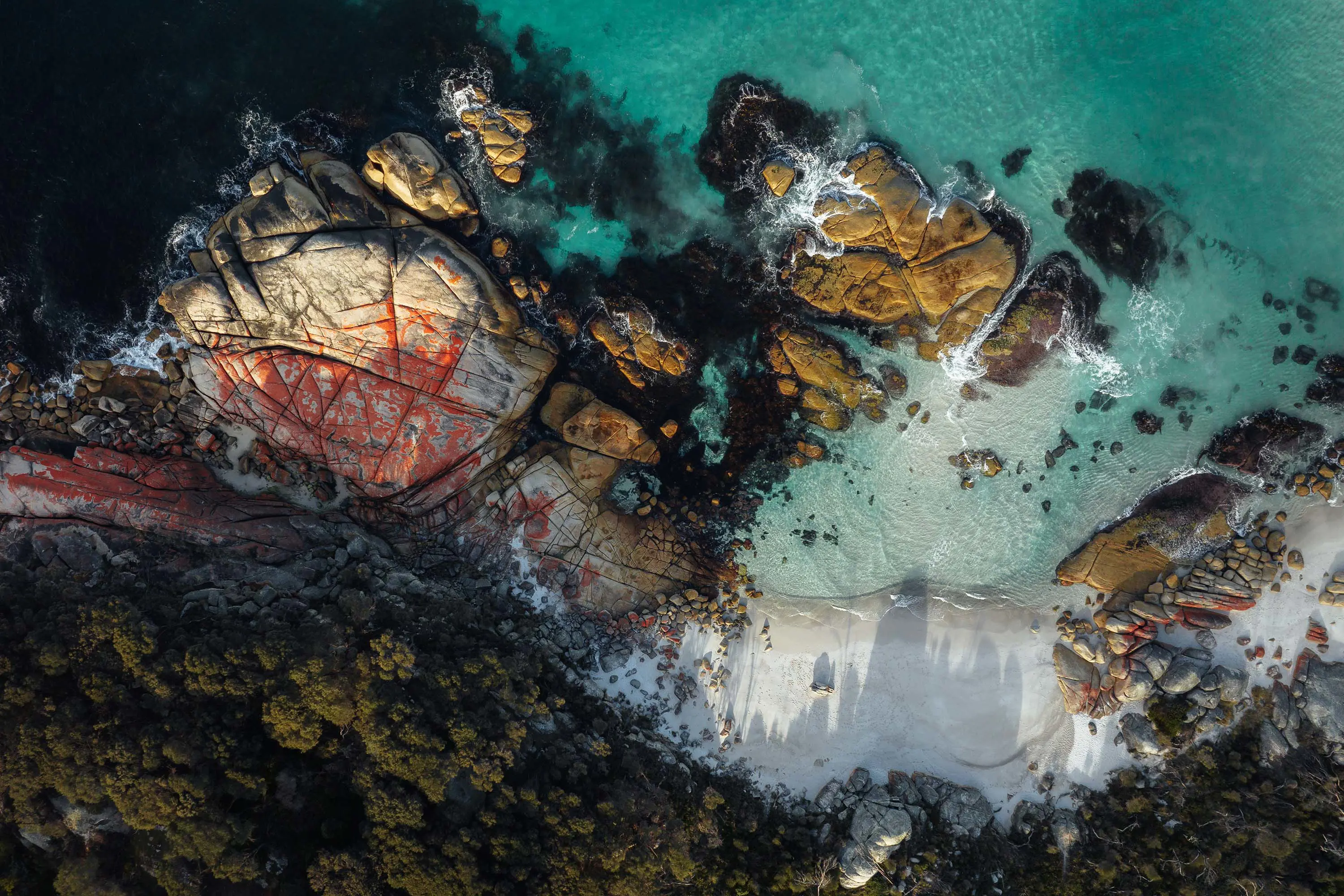
Tasmania’s rockpools are microcosms of our earthly existence, with all of life’s dramas played out on a small stage. Take a break from the day-to-day and tinker around amongst the starfish, crabs and little shells, surviving and thriving as the tide flows around them.
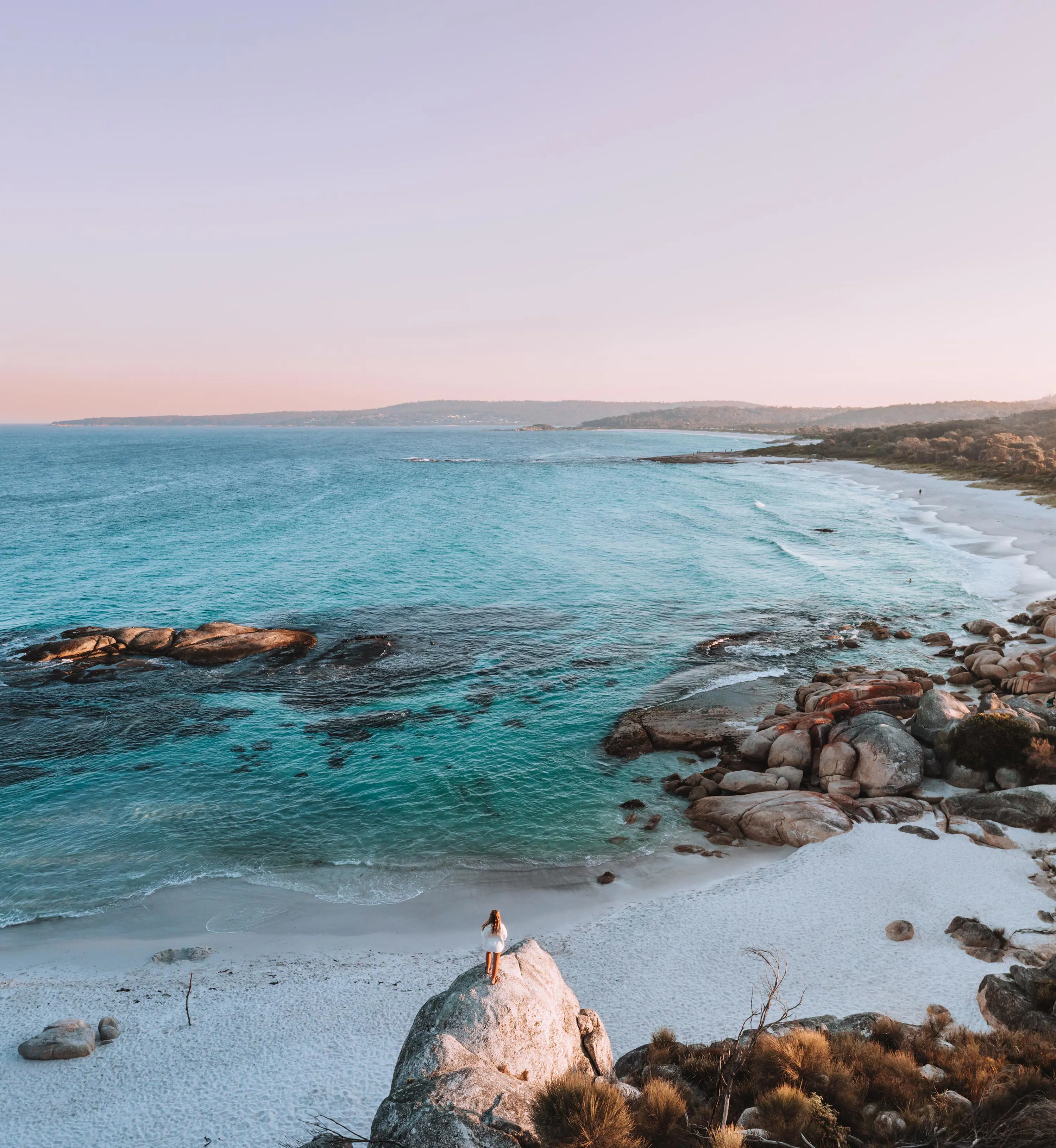
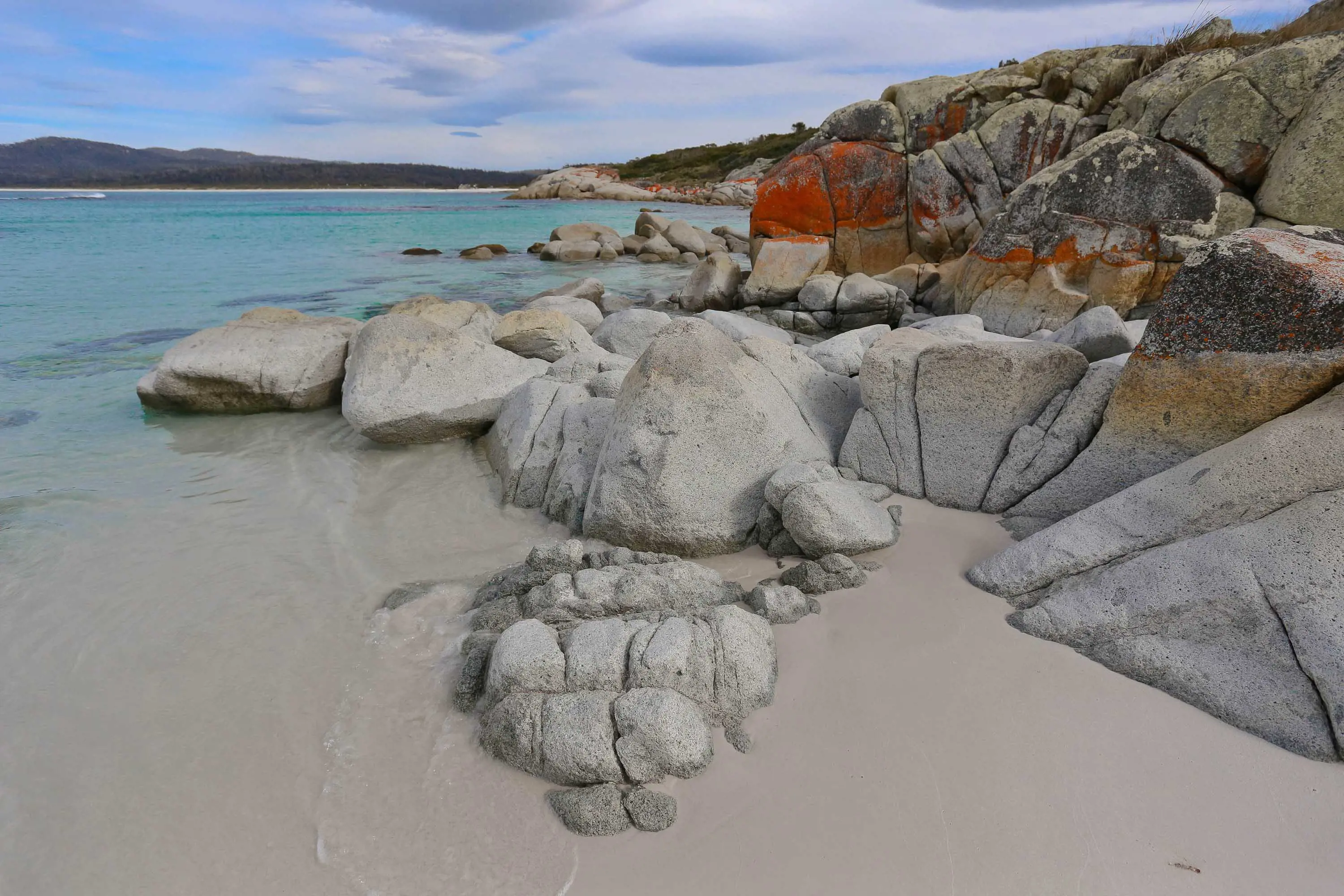
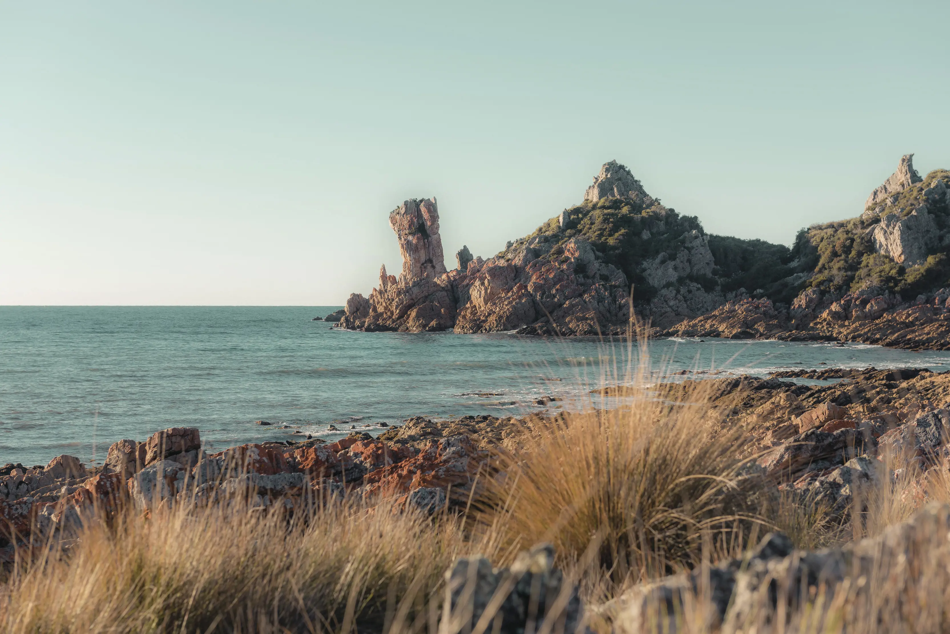
On the north-east coast in the Larapuna area, the Bay of Fires gets plenty of Insta-love. But forget about muscle shots and swimsuit snaps: there’s enough room along this 50km coastline to find a private rockpool to dunk yourself in, far from social scrutiny. Take a likin’ to the lichen on a big granite boulder as you dry off in the sea breeze.
The Gardens, Bay of Fires Conservation Area
On the photogenic north-west coast near Wynyard, find fossils in the rockpools at Fossil Bluff, or find your fortune at Doctors Rocks. Local legend has it that there's a lost gold reef somewhere offshore here, and nuggets do occasionally wash in on the waves.
At Killiecrankie Bay on Flinders Island, fossick for Killiecrankie Diamonds — ice-clear and pink-gold chunks of topaz, smoky quartz, zircon and beryl — awash in the rockpools at low tide. Some say that topaz crystals have the power to calm, heal and rejuvenate...which might be just what you're looking for.
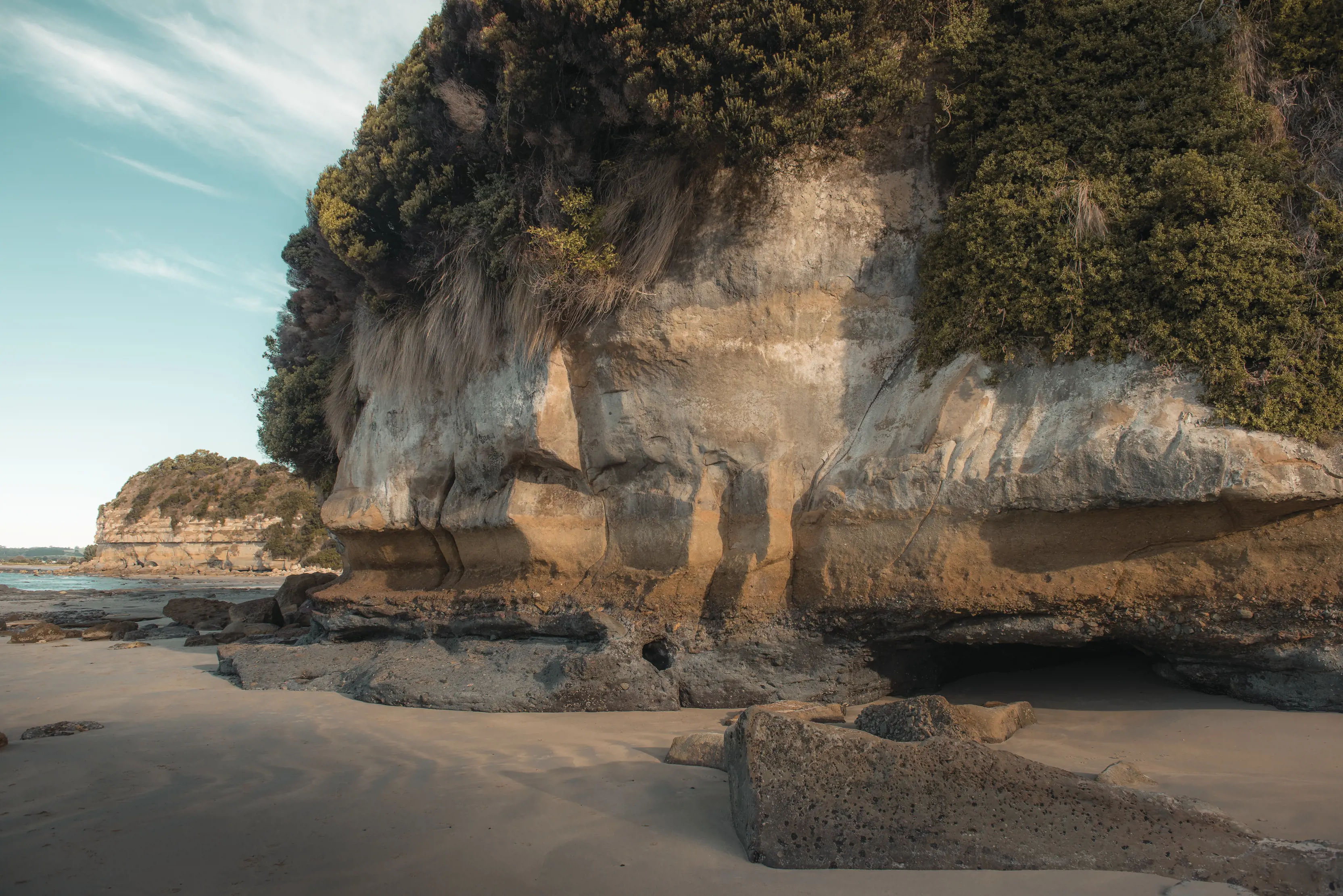
Of course, Tasmania's rockpools require some accompanying geology to make the magic happen — granite boulders, fossil-filled cliffs and fragmented sandstone terraces, many millions of years old. Timeless Palawa (Tasmanian Aboriginal) stories also play out in these rockscapes: cultural living sites, carvings and caves that are sacred reminders of the unbroken Palawa connection to Country.
In the south east, Tessellated Pavement at Teralina / Eaglehawk Neck is one of many kooky geological rock formations on Turrakana / Tasman Peninsula (blowholes, arches, cliffs, sea caves...). The tide surges across this scarified stone flatland, decorating it with shells, driftwood and sea life.

In between Blackmans Bay and the agreeably named Tinderbox just south of Hobart, wander down to the shore and discover fossilised evidence of 250-million-year-old life at the Fossil Cove Conservation Area.
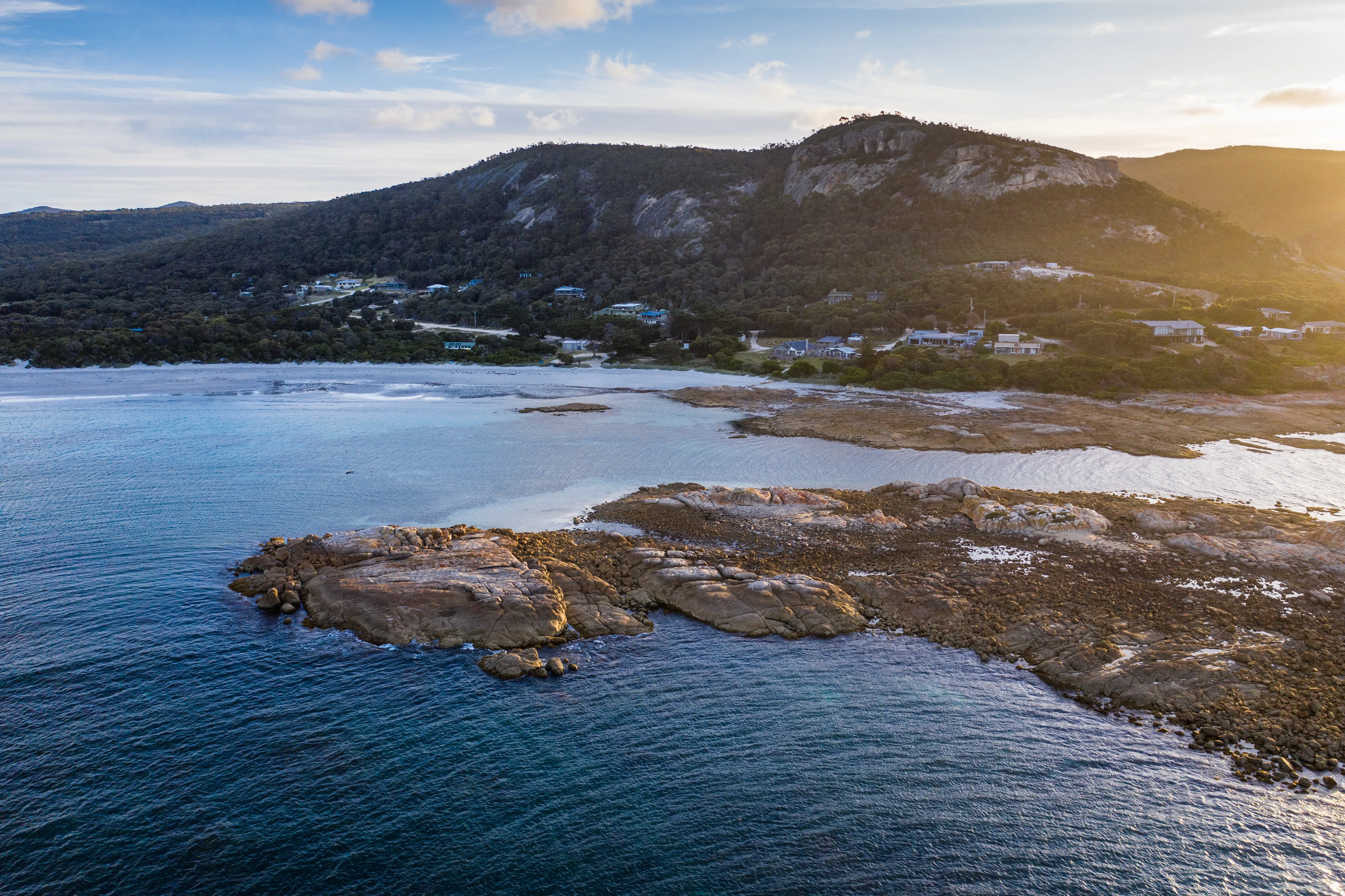
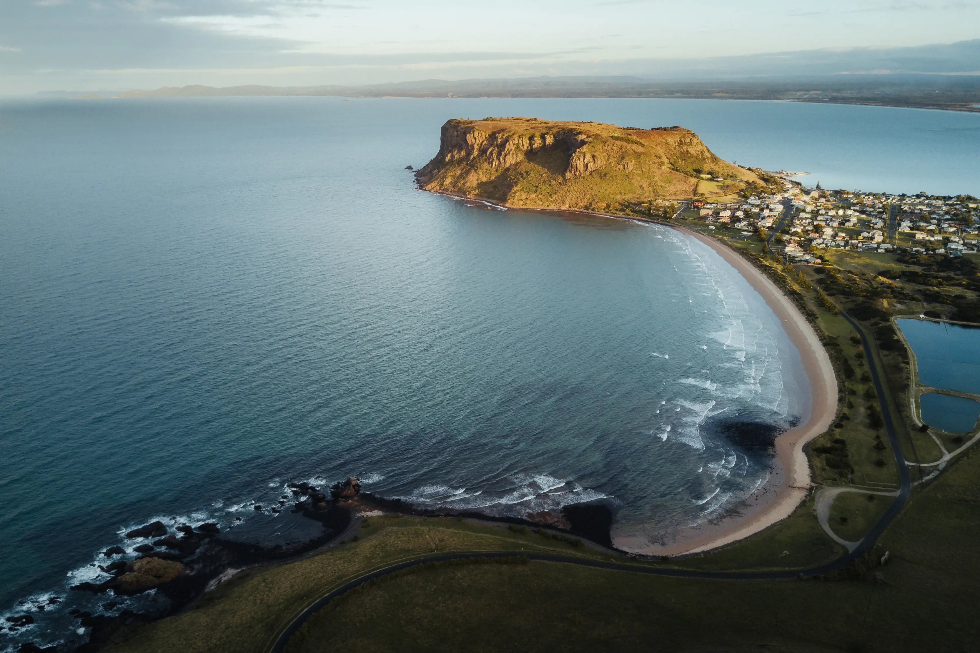
Heading into the north west, two flat-top basalt plateaus — the Nut at Stanley and Table Cape near Wynyard — jag into Bass Strait like giant car ferries setting sail for the mainland. In between is Rocky Cape National Park, layered with culture as much as geology. The metamorphic rock formations here are peppered with Palawa rock shelters, carvings, artefacts and cultural living sites. Respect is the name of the game: look, but don't touch.
Upstream from the north coast along Kanamaluka / River Tamar, Cataract Gorge in Launceston is another significant place for Palawa people. There are walking trails, swim spots, eateries, historic bridges and wandering peacocks here...but the rocks are the real stars: sheer dolerite cliffs and fractured black boulders, with the South Esk River surging through. It's a thought-provoking place.
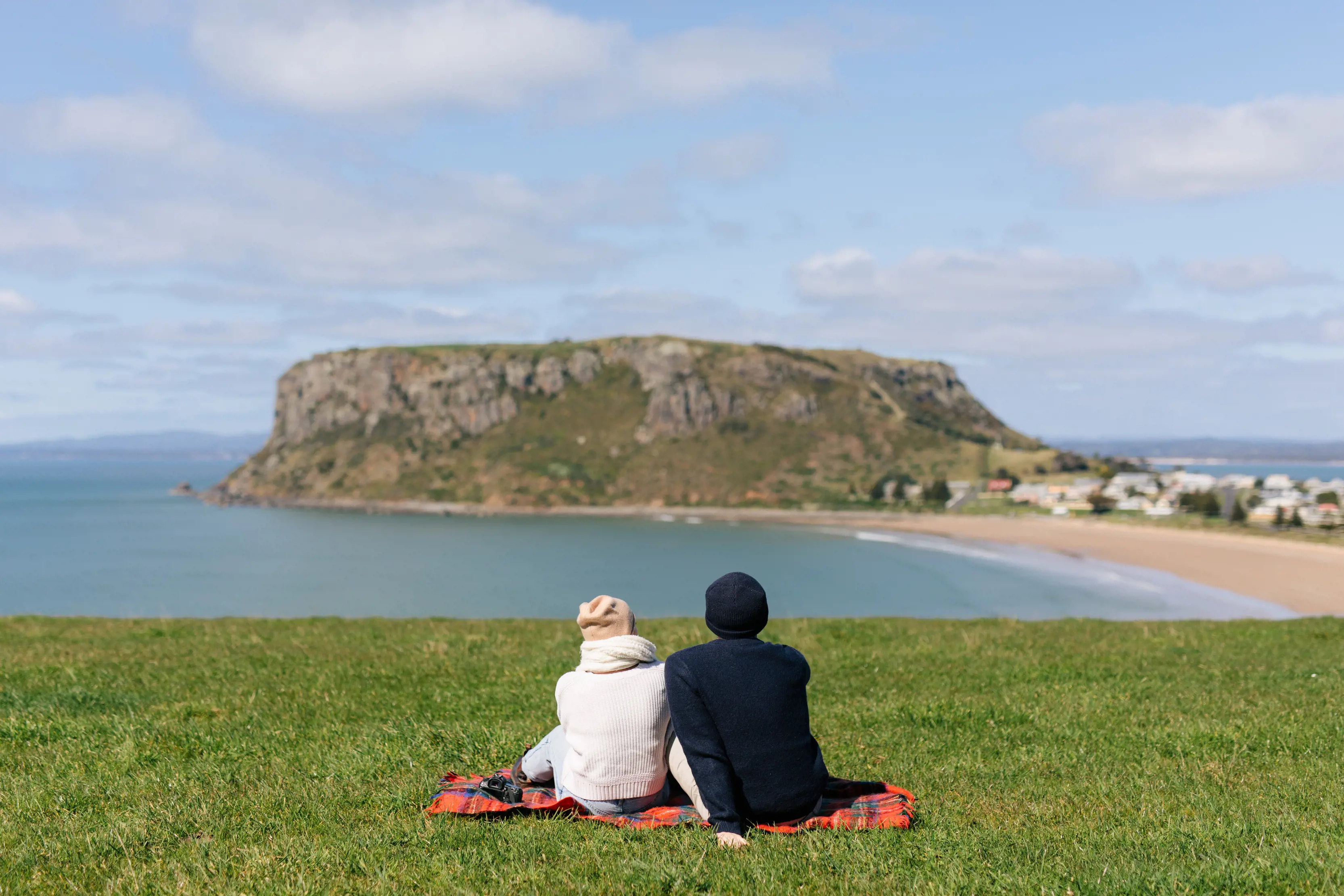
The Nut, Stanley
Pinmatik / Rocky Cape Circuit Track, Rocky Cape National Park
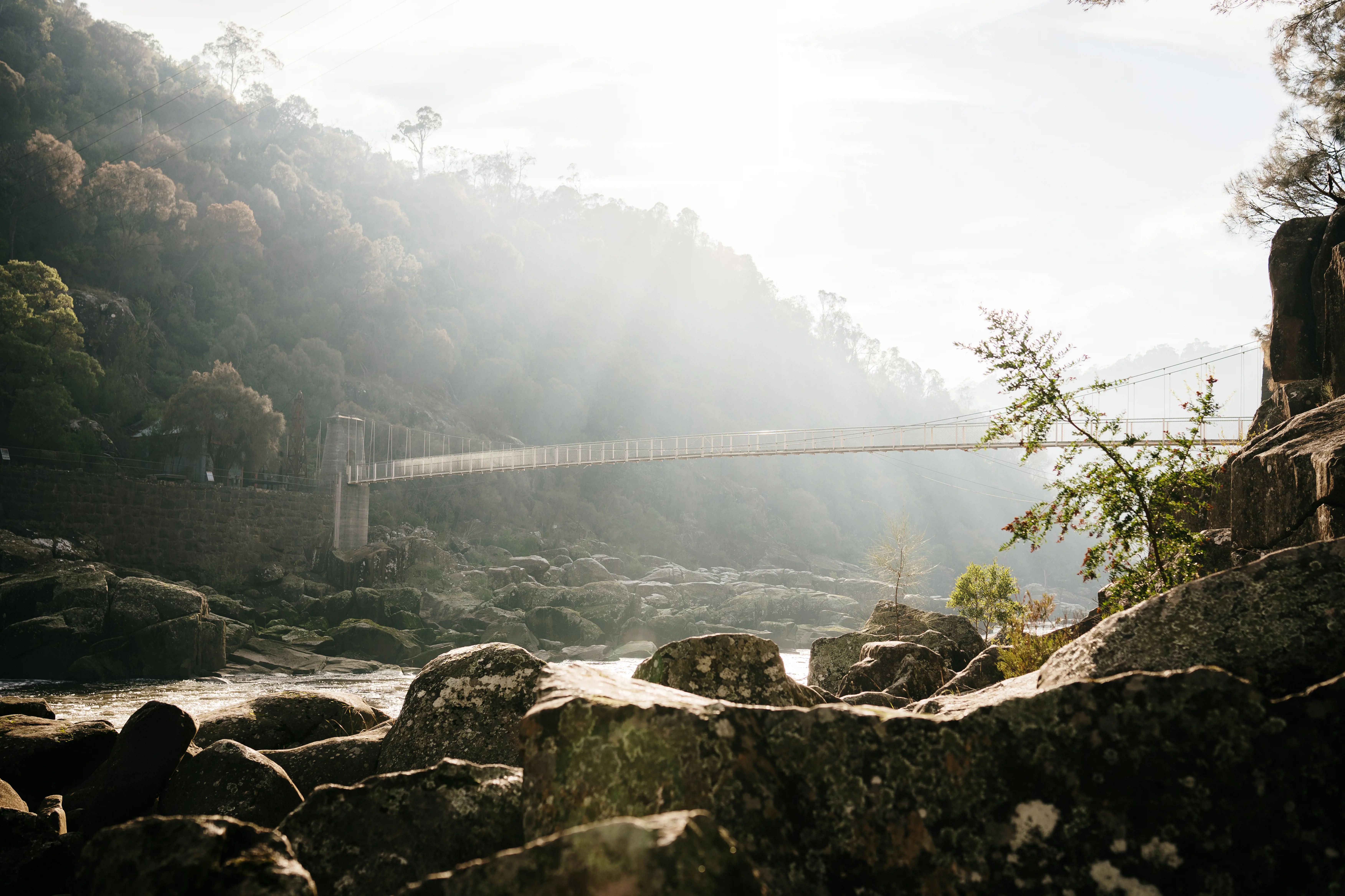
Duck Reach, Cataract Gorge Reserve
Plot a pathway across Tasmania with our Trip Planner, helping you explore, build, save and share your itinerary before you arrive.
Get started