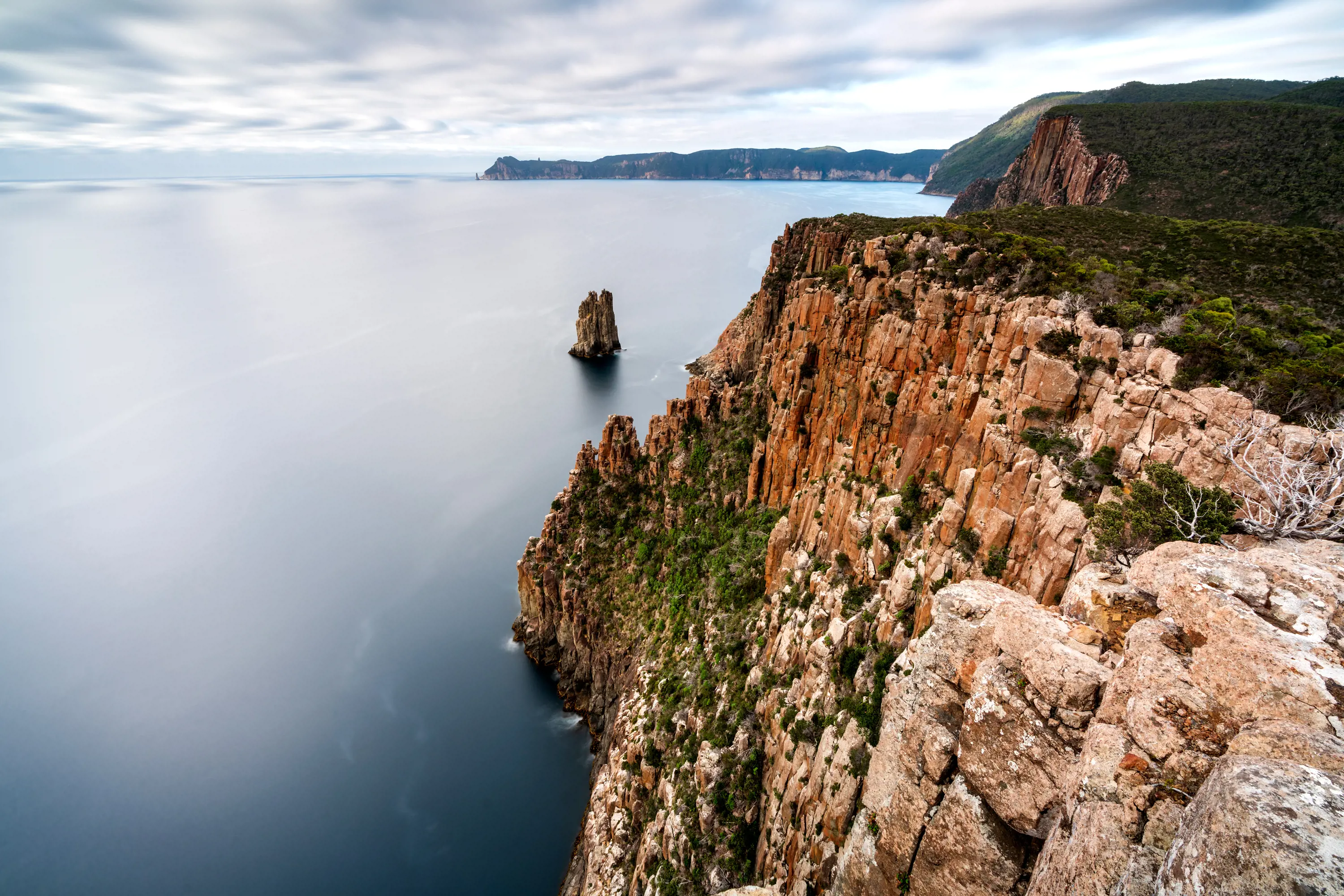
Cape Hauy
Tasmania Parks and Wildlife Service
Access your favourites here
You have a trip stored, would you like to save it?
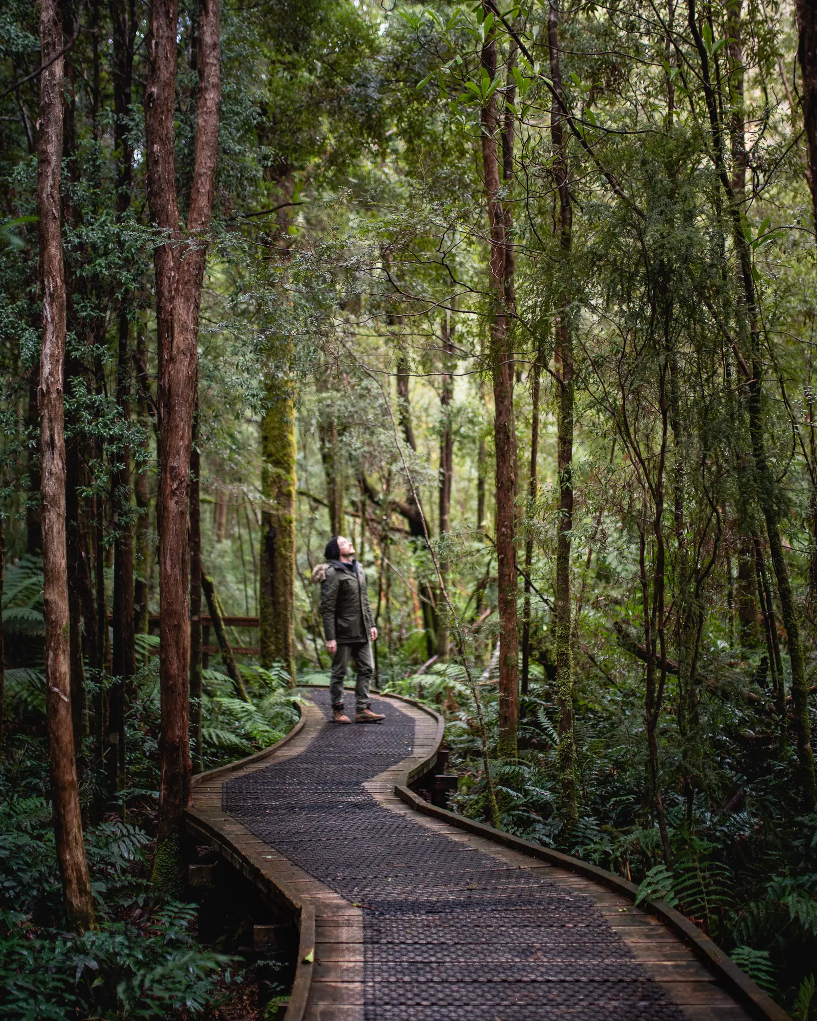
Tasmania’s walking reputation is founded on its epic trails: the Overland Track, the South Coast Track, Frenchmans Cap. But you don’t have to walk far to see some of the state’s most spectacular natural sights.
Short walks are threaded across the island, including the collection of 60 Great Short Walks put together by the Tasmania Parks and Wildlife Service.
Compress the rewards of walking in Tasmania on these favourite day walks.
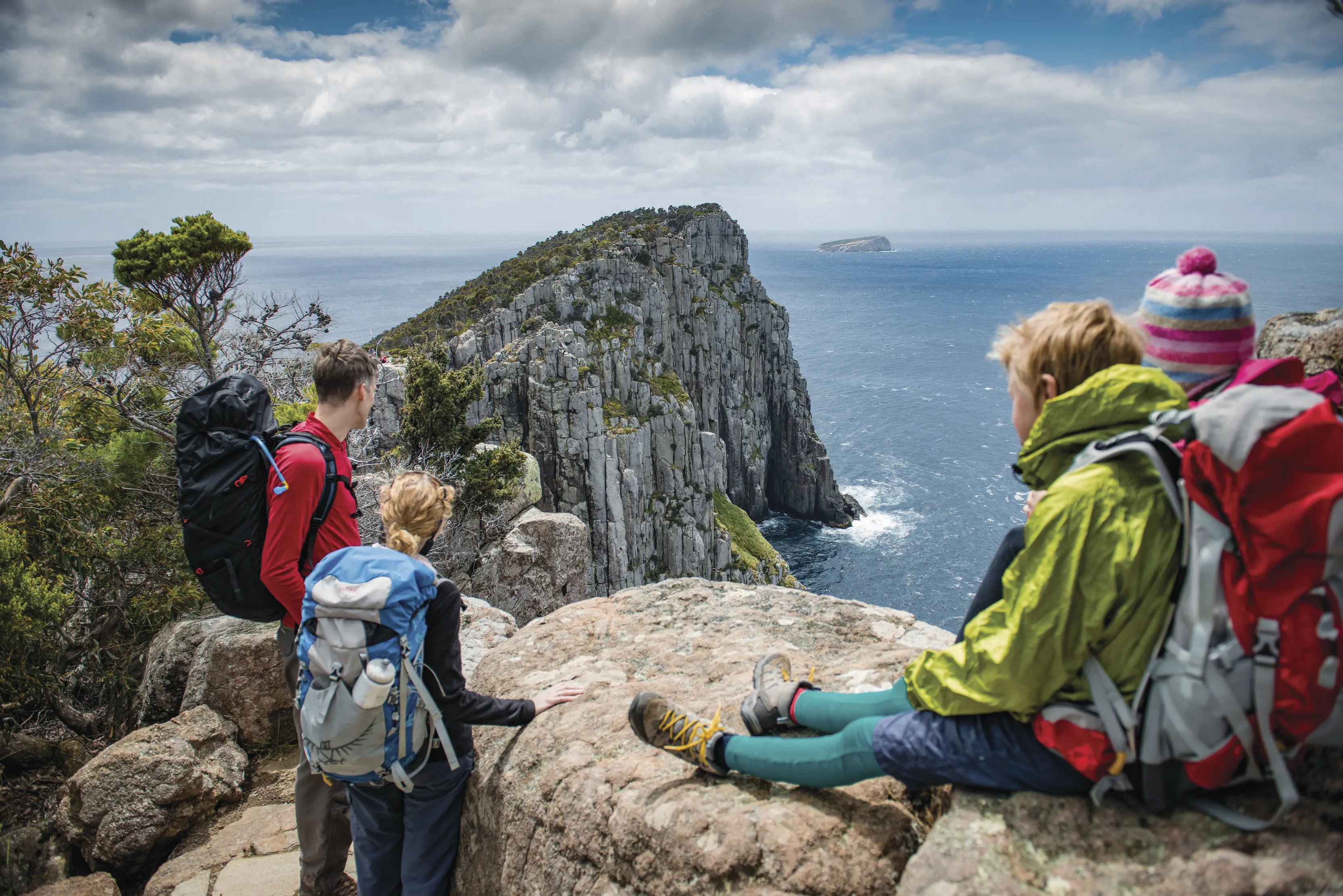
One of the namesake capes on the Three Capes Track, Cape Hauy doubles as a great day walk in its own right. From Fortescue Bay, the 4hr return walk follows the coast to the ever-narrowing cape, emerging to a memorable view of Australia’s highest sea cliffs and down onto the Totem Pole and Candlestick, a pair of sea stacks famed among rock climbers.
Start and finish: Fortescue Bay, Tasman National Park.
Time and distance: 4hr return, 9.4km.
Where: Fortescue Bay is a 90min drive (110km) south-east of Hobart. A parks pass is required.
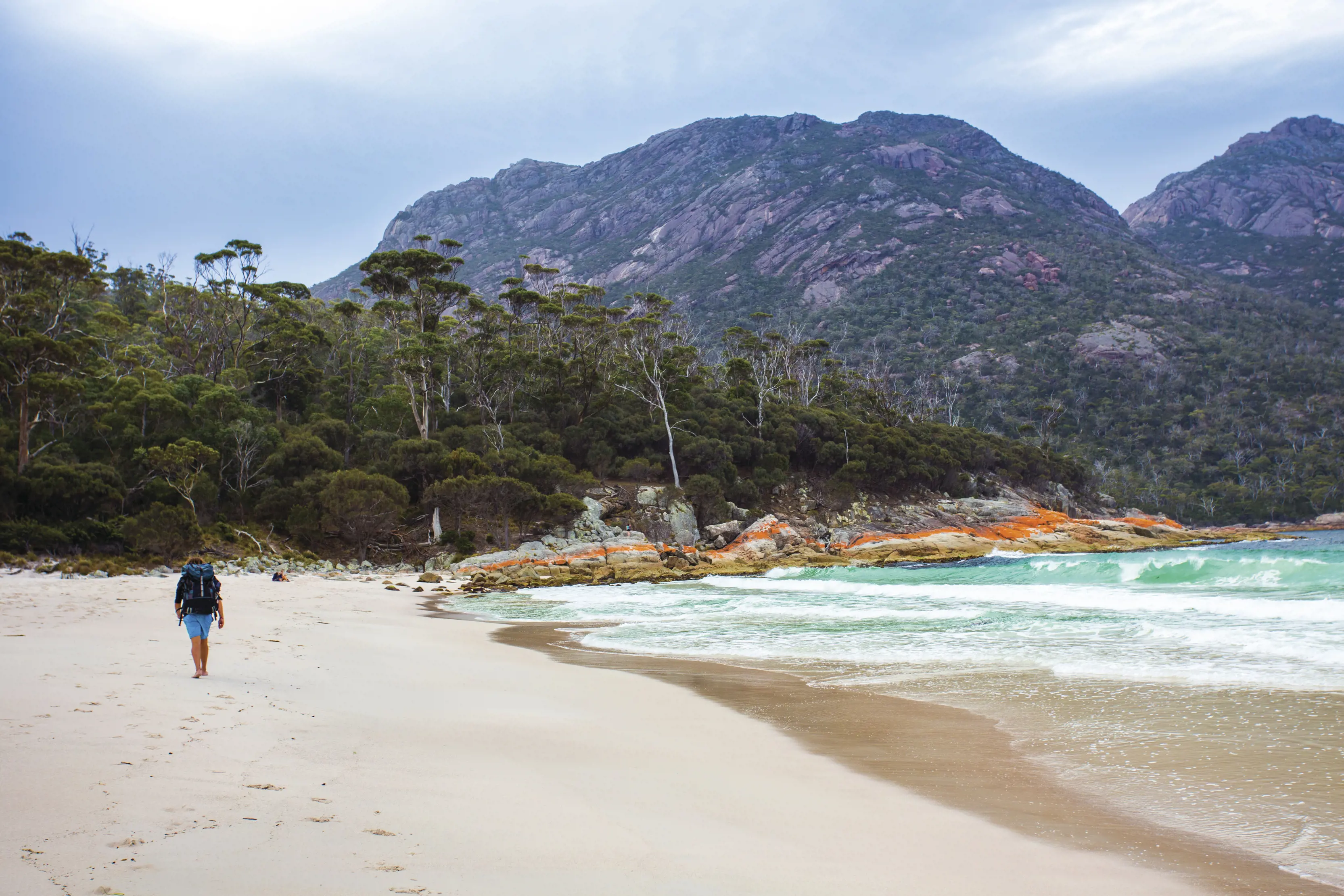
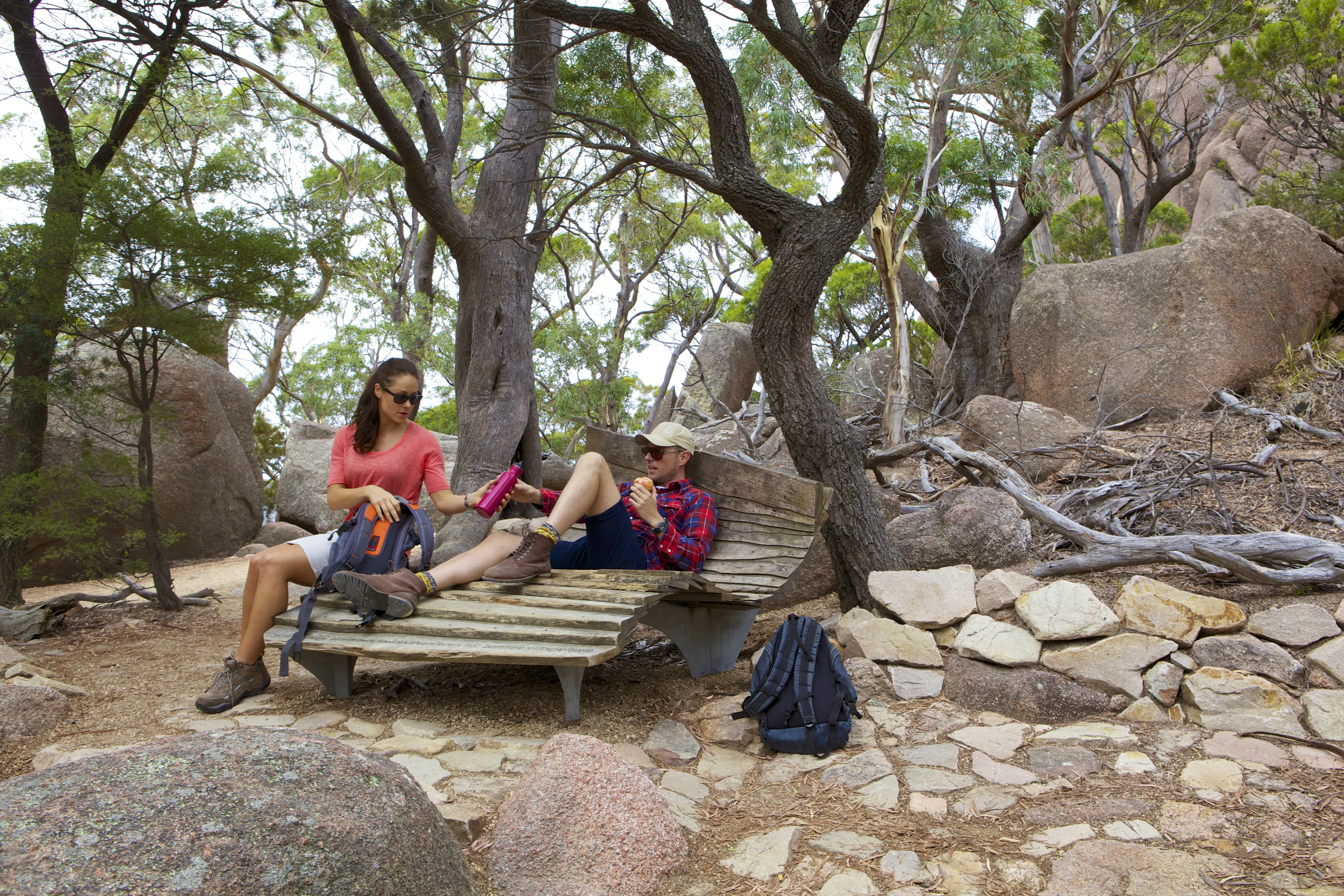
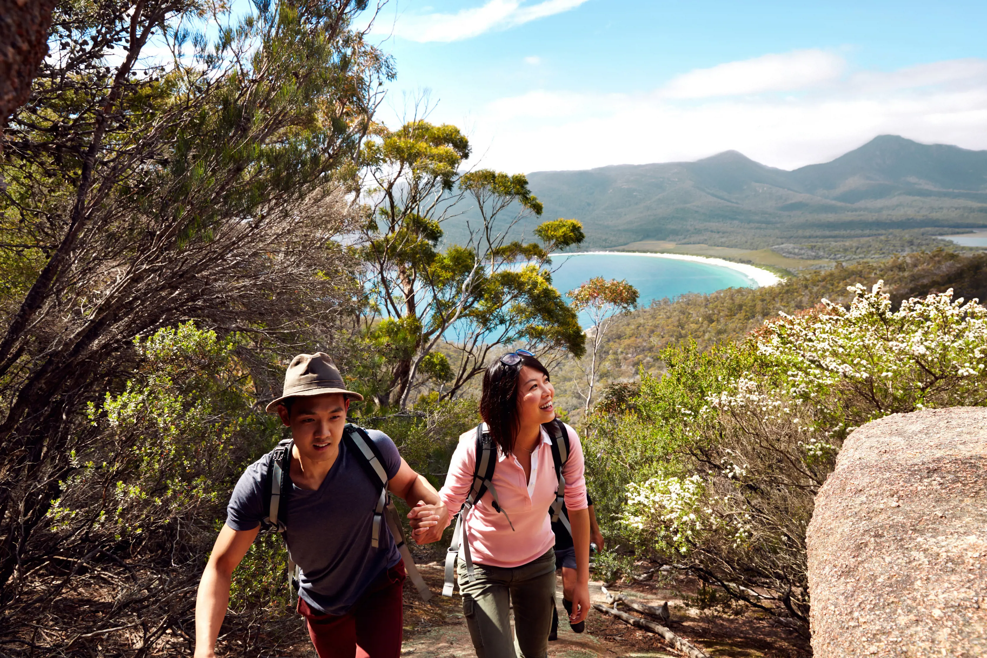
See, touch and experience Tasmania’s most famous beach on this 4-5hr loop that also reveals so much more of Freycinet National Park. Climb through a low gap in the Hazards to the Wineglass Bay Lookout and then descend to the sands of the perfectly curved beach itself. Plunge in for a swim, then cross the narrow isthmus to Hazards Beach, before rounding the coast across the toes of the Hazards and back to the car park.
Start and finish: Freycinet Dr, Freycinet National Park.
Time and distance: 4-5hr return, 11km.
Where: The walk is a 2hr 30min drive (195km) north-east of Hobart and a 2hr drive (175km) south-east of Launceston. There’s no drinking water along this walk, so pack all that you’ll need. A parks pass is required.
Great Walks of Australia (Freycinet Experience Walk)
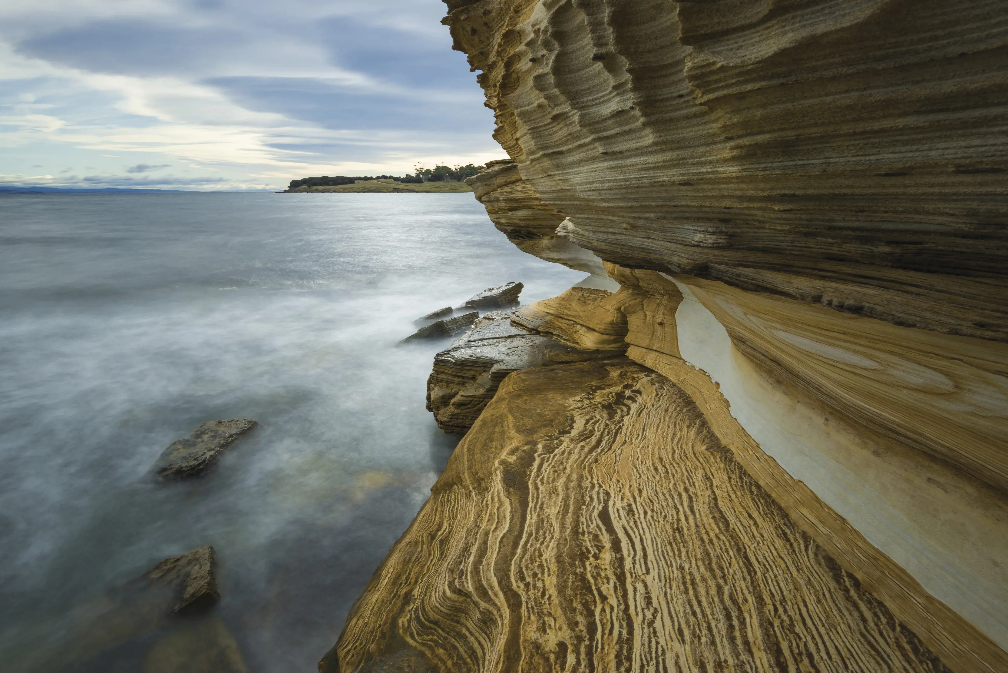
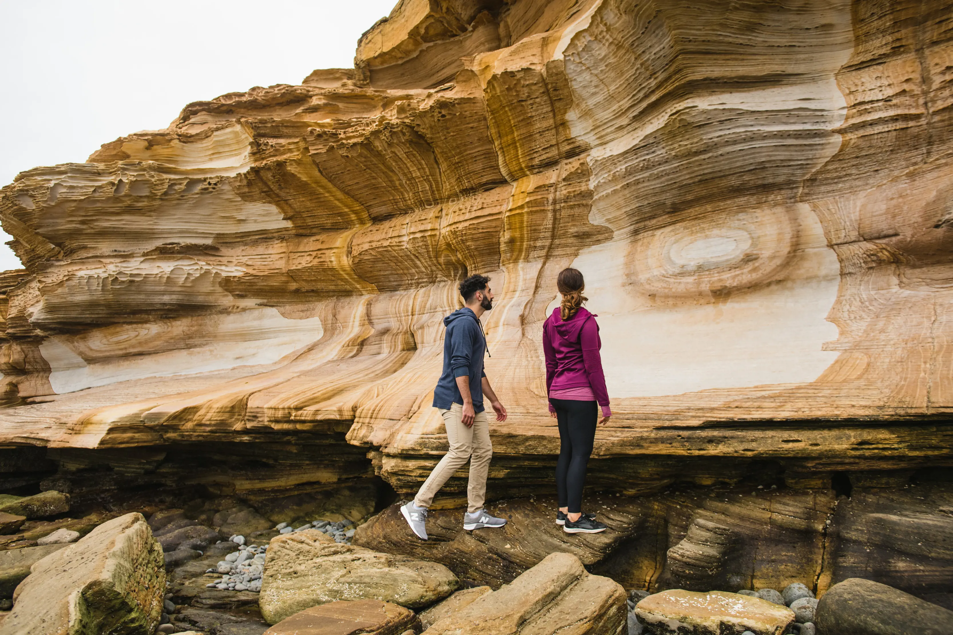
You’ll be in the most charming of walking company – wombats – on this 2hr return walk on Maria Island, from the World Heritage-listed convict station of Darlington to the swirling patterns of the Painted Cliffs. Wombats graze the grassed clearings as the walk climbs out of Darlington, descending to the white sands of Hopground Beach and the swirls of the ornately patterned cliffs.
Start and finish: Darlington, Maria Island National Park.
Time and distance: 90min-2hr 30min return, 4.3km.
Where: Encounter Maria Island operates daily ferries to Maria Island from Triabunna, which is a 70min drive (90km) north-east of Hobart and a 2hr drive (185km) south-east of Launceston. Note: the cliffs can be seen only close to low tide. When you're at the cliffs, watch for slippery rocks and possible wave surges. A parks pass is required.
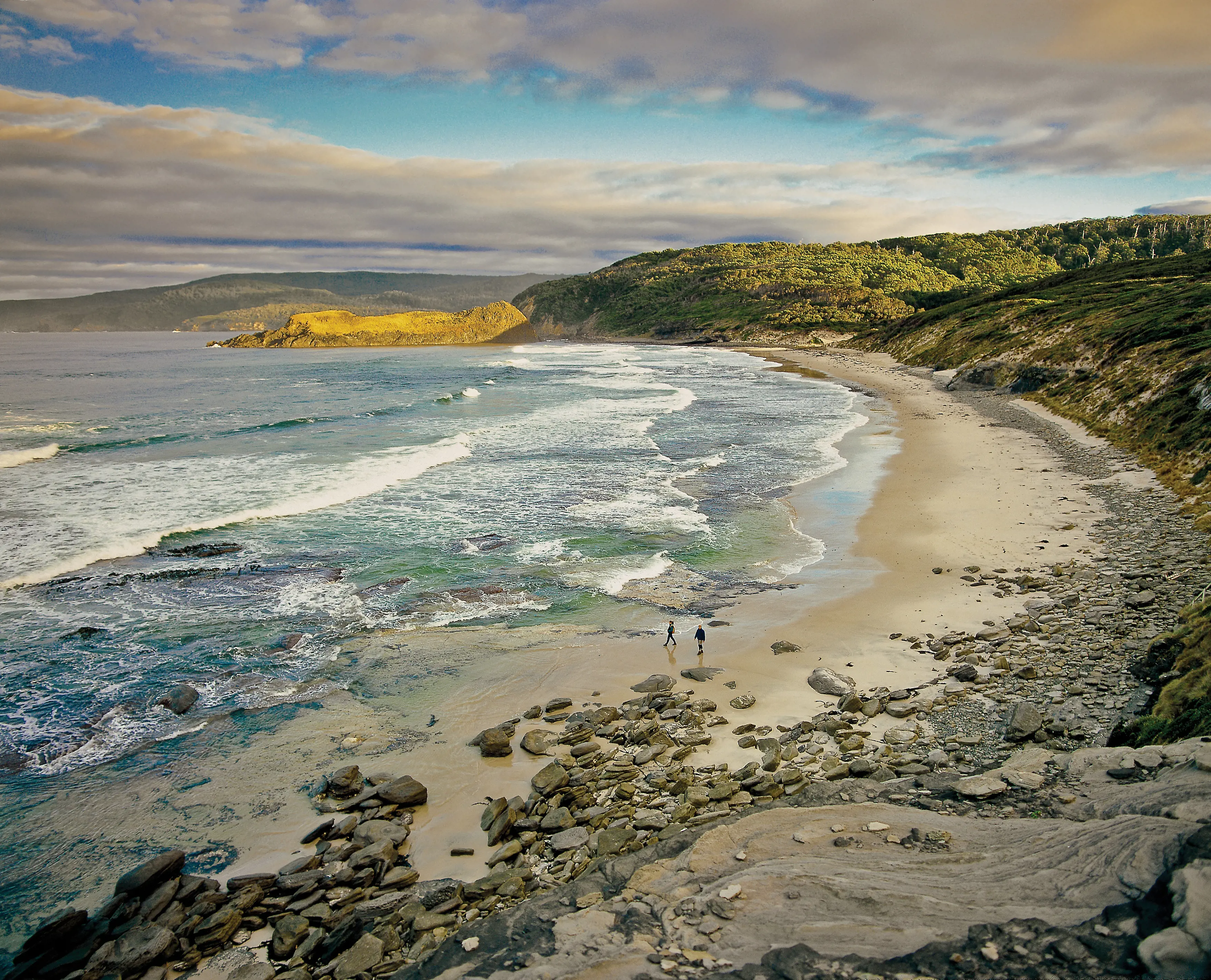
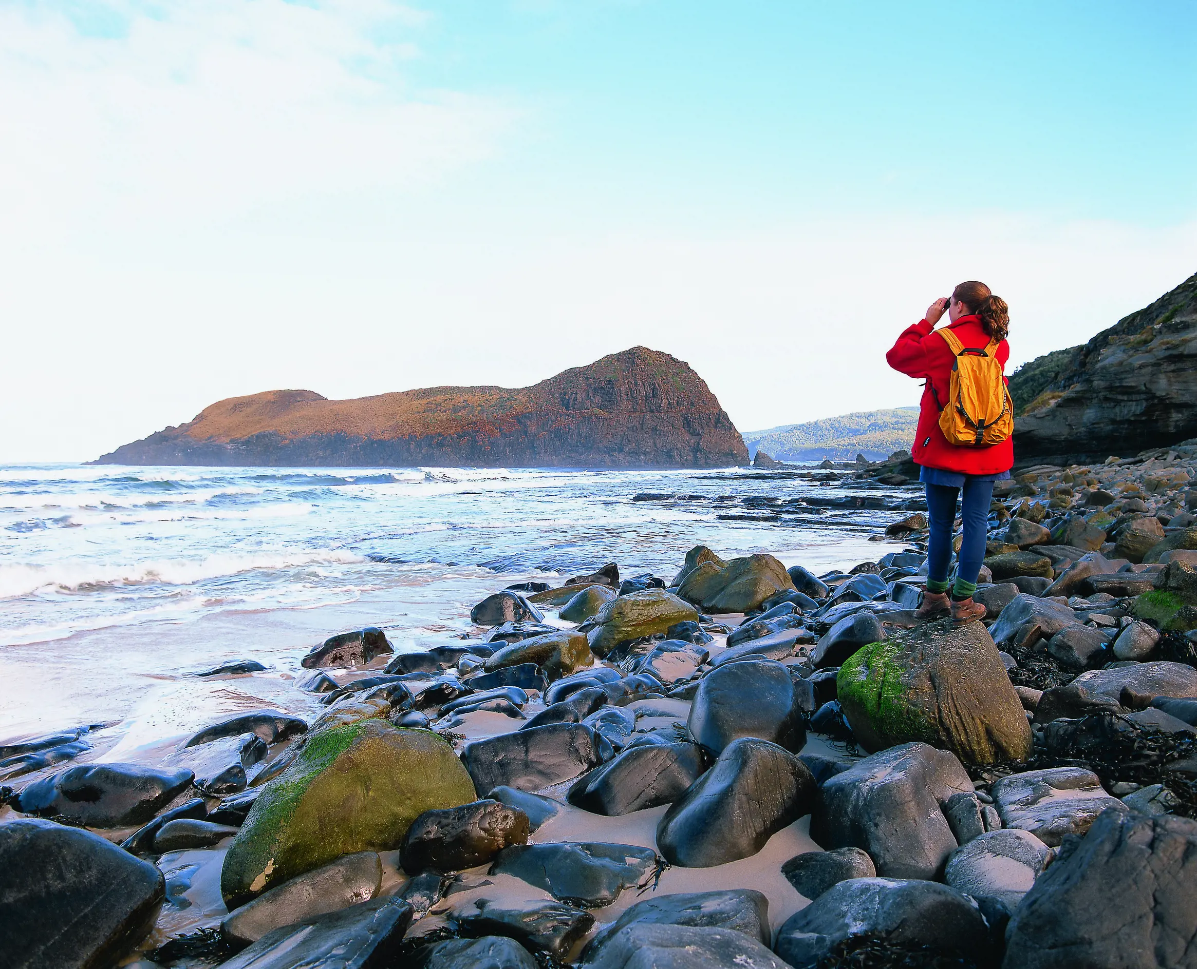
Doubling as a taster of the week-long South Coast Track, this 4hr trail sets out from the southernmost road end in Australia at Cockle Creek and heads to Tasmania’s wild southern shores. Emerging atop coastal cliffs, there’s a sudden and stunning view over the Southern Ocean and to nearby South East Cape, Australia’s most southerly point. Walk along the beach for another kilometre and you come to the monumental Lion Rock just offshore.
Start and finish: Cockle Creek.
Time and distance: 4hr return, 15.4km.
Where: Cockle Creek is a 2hr drive (120km) south-west of Hobart. A parks pass is required.
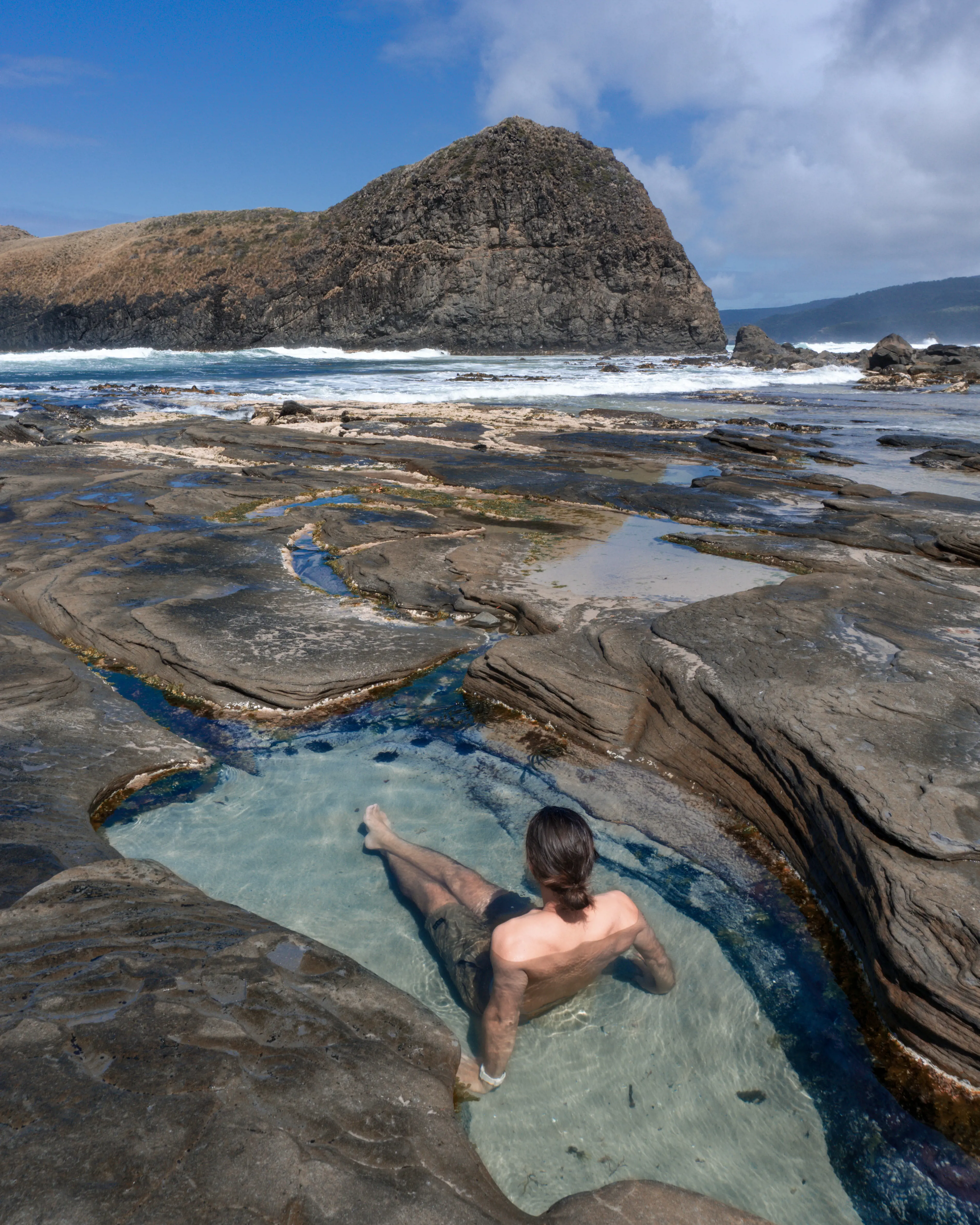
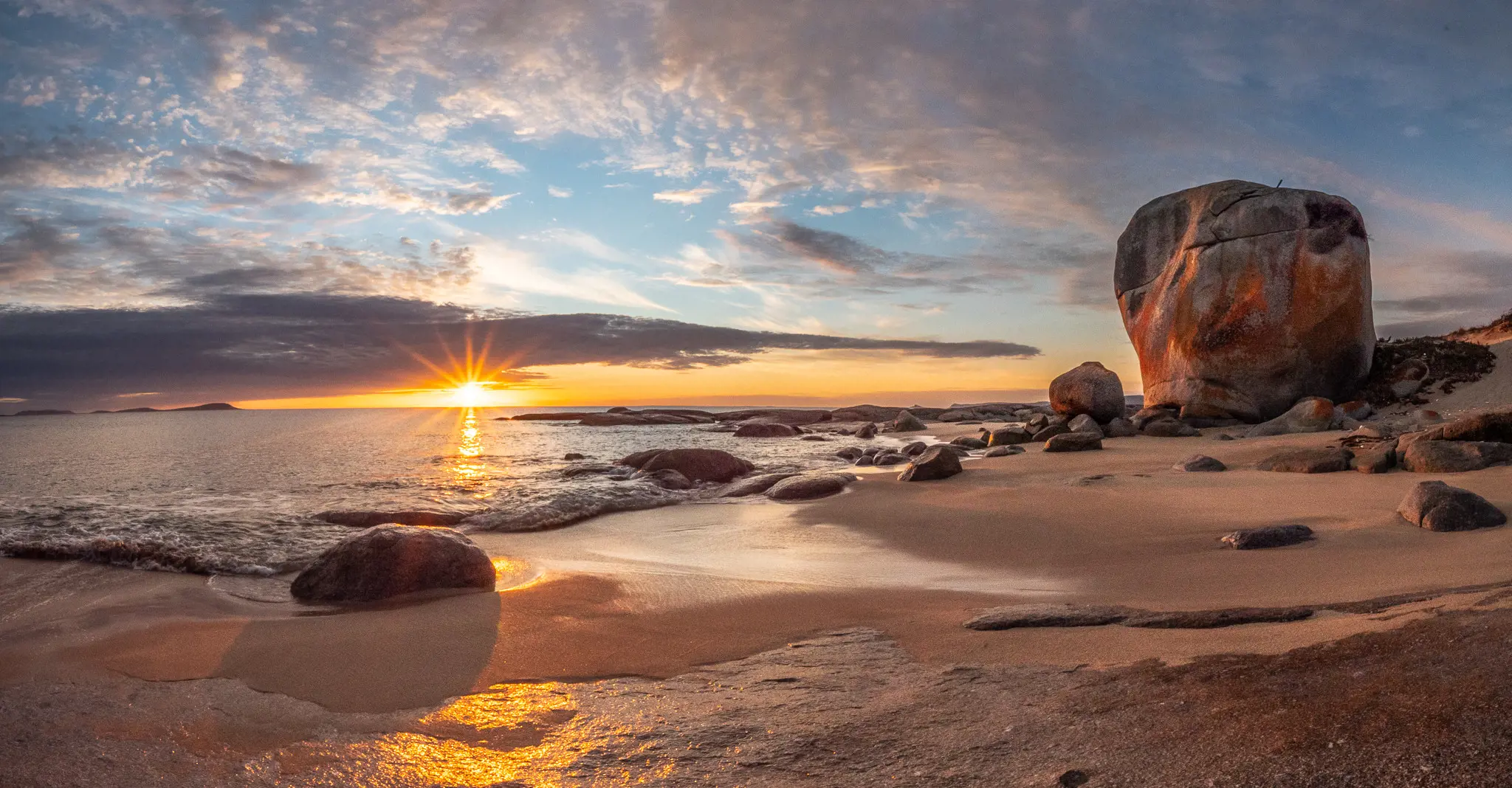
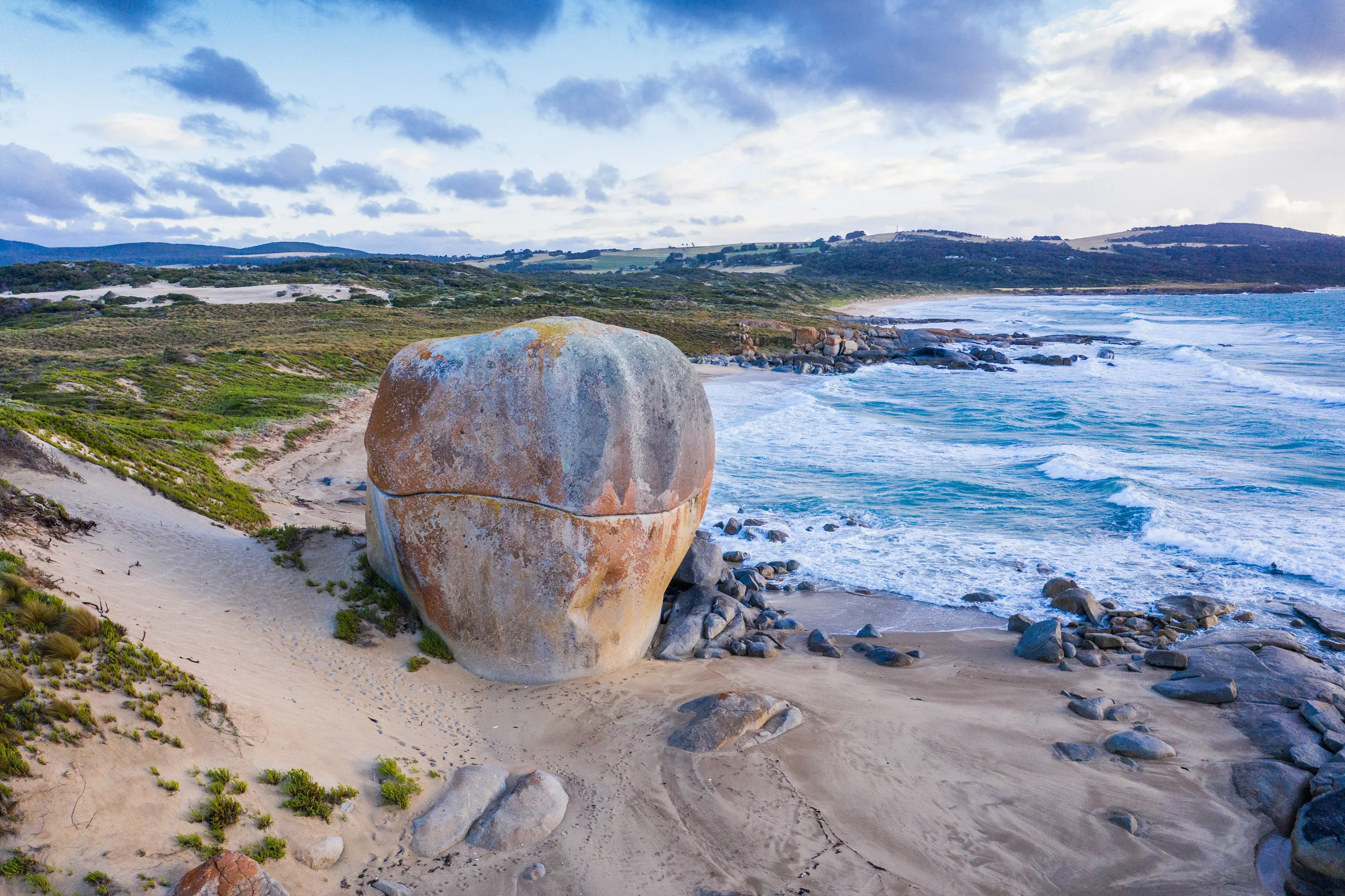
As monolithic as its name suggests, Castle Rock is a massive, lichen-blazed boulder set in the sands of Marshall Beach on Flinders Island. The 90min return walk predominantly follows the beautiful white-sand beach, darting inland only to skirt a rocky headland before arriving in the long shadow of the giant rock, which dwarfs all around it, including walkers. Sunset is prime Castle Rock time.
Start and finish: Allports Beach, Flinders Island.
Time and distance: 90min return, 6.6km.
Where: Sharp Airlines flies to Flinders Island from Launceston, Hobart and Melbourne. The start of the walk is a 15min drive (15km) from Whitemark, the island’s largest town.
For high alpine terrain in easy reach of Hobart, and a peek into the Tasmanian Wilderness World Heritage Area, Hartz Peak is unsurpassed. The 3-5hr walk passes a pair of alpine lakes – Lake Esperance and Ladies Tarn – before ascending steeply to Hartz Pass and entering true mountain terrain as it rises onto the summit of 1254m-high Hartz Peak. On a good day, the view stretches across the wilderness mountains to the west.
Start and finish: Hartz Rd, Hartz Mountains National Park.
Time and distance: 3-5hr, 7.4km.
Where: The walk is a 90min drive (86km) south-west of Hobart. Weather can be changeable and severe at this altitude, so check the weather forecast before setting out and carry plenty of warm clothing. A parks pass is required.
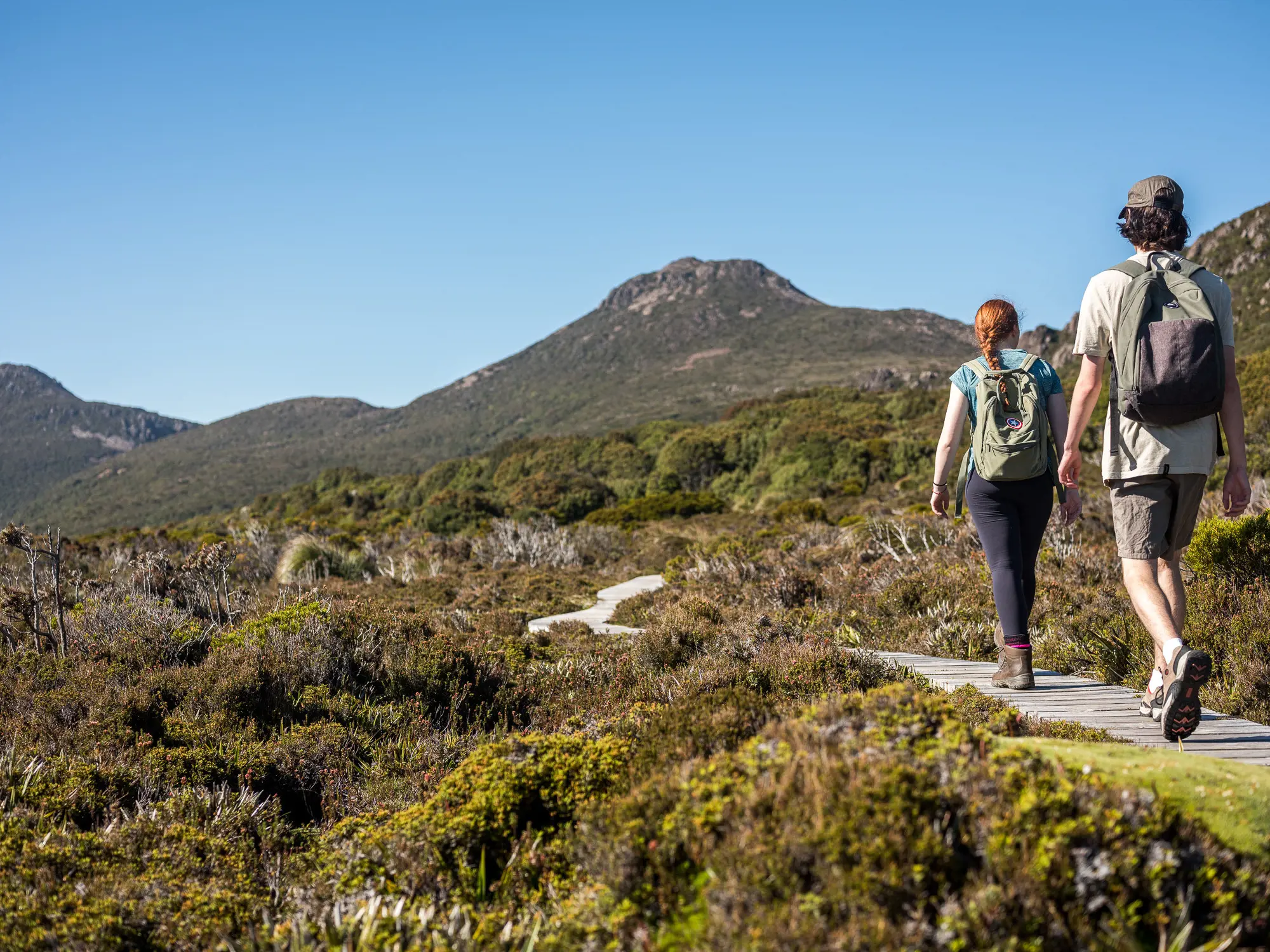
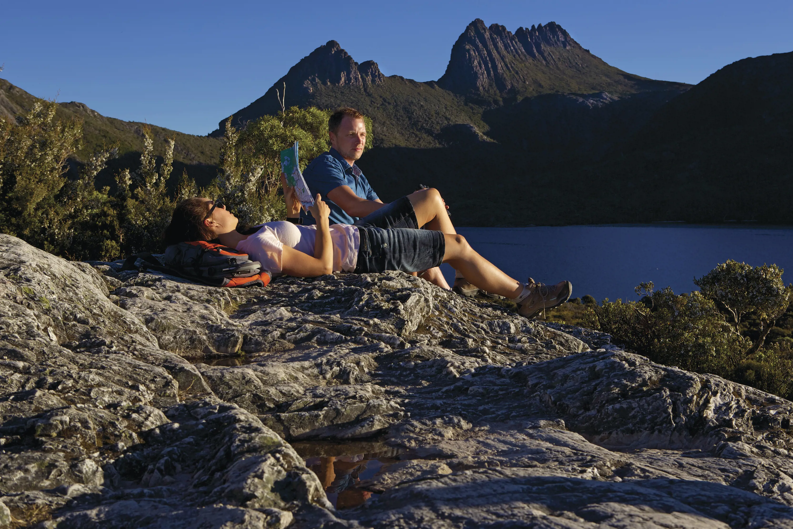
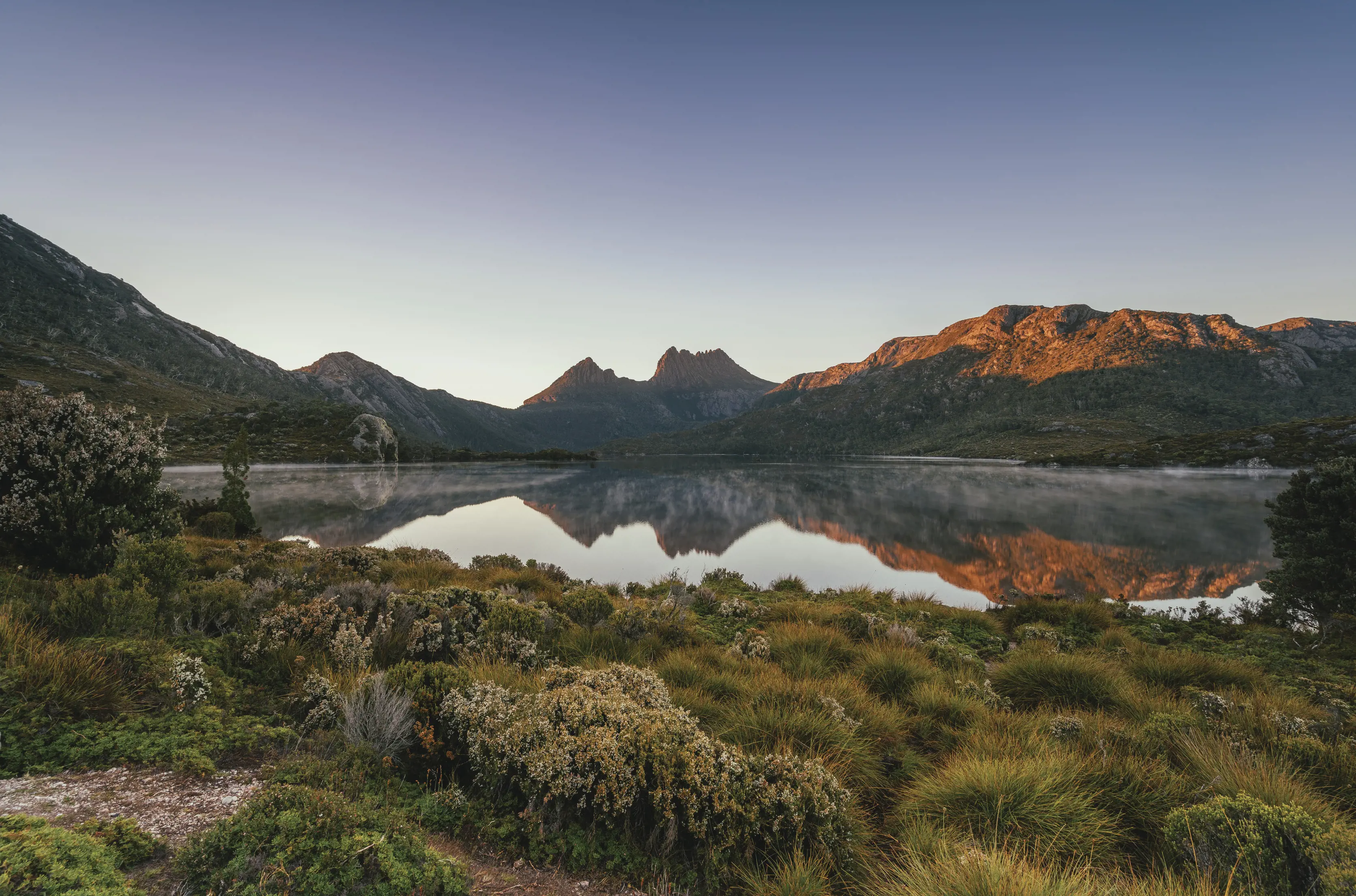
Walk a lap around this high mountain lake, with the bowed figure of Cradle Mountain towering overhead. The 2-3hr circuit undulates around the shores and passes directly beneath the nose of the mountain. There’s a stunning section of rainforest, wide mountain views from atop Glacier Rock, and a famously photogenic boat shed on a gravelly beach.
Start and finish: Dove Lake Rd, Cradle Mountain-Lake St Clair National Park.
Time and distance: 2-3hr return, 6km.
Where: The Cradle Mountain Visitor Centre is a 2hr drive (140km) west of Launceston and a 4hr drive (320km) north-west of Hobart. Shuttle buses run from the visitor centre to Dove Lake – a bus fare of $15 applies for all adult visitors.
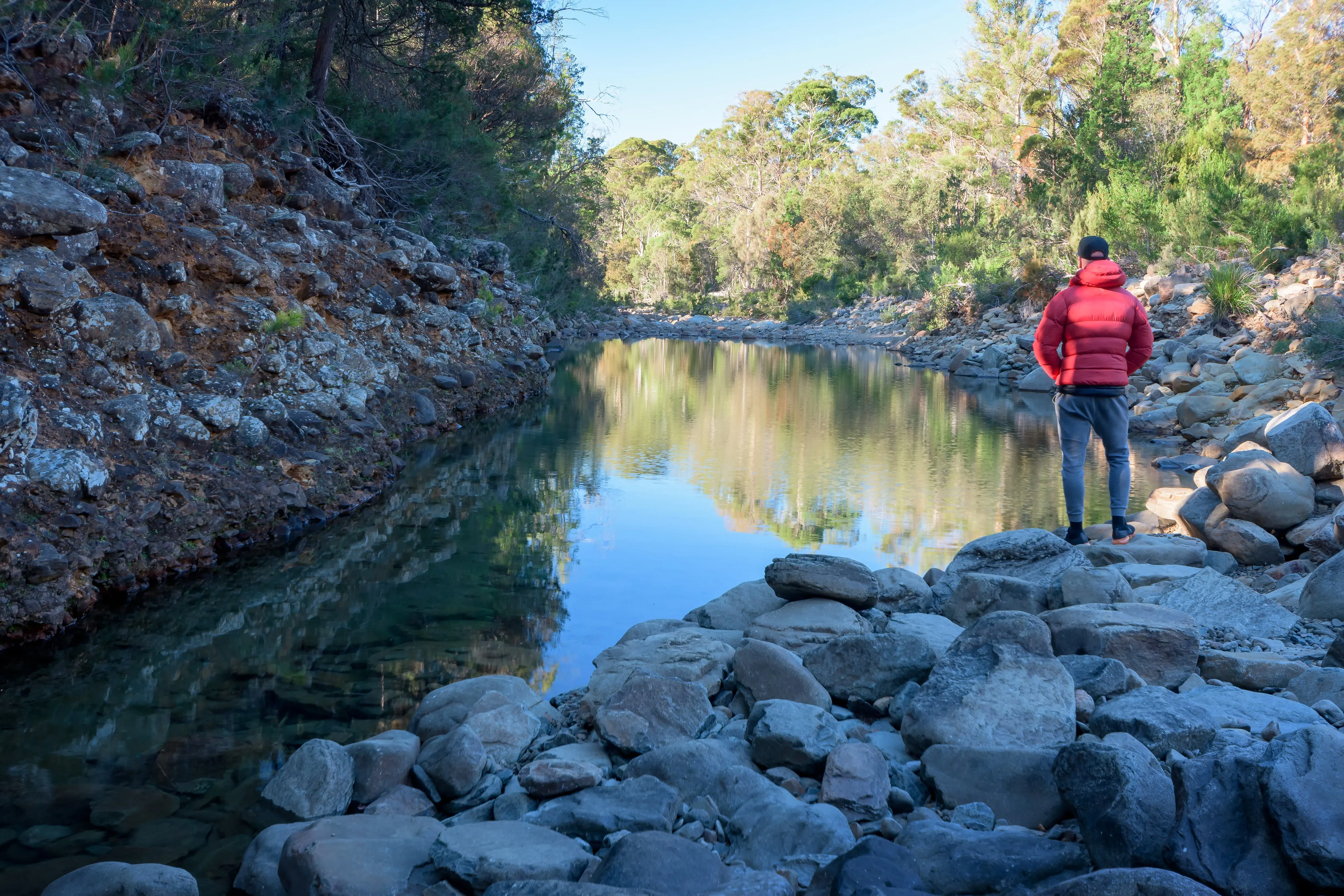
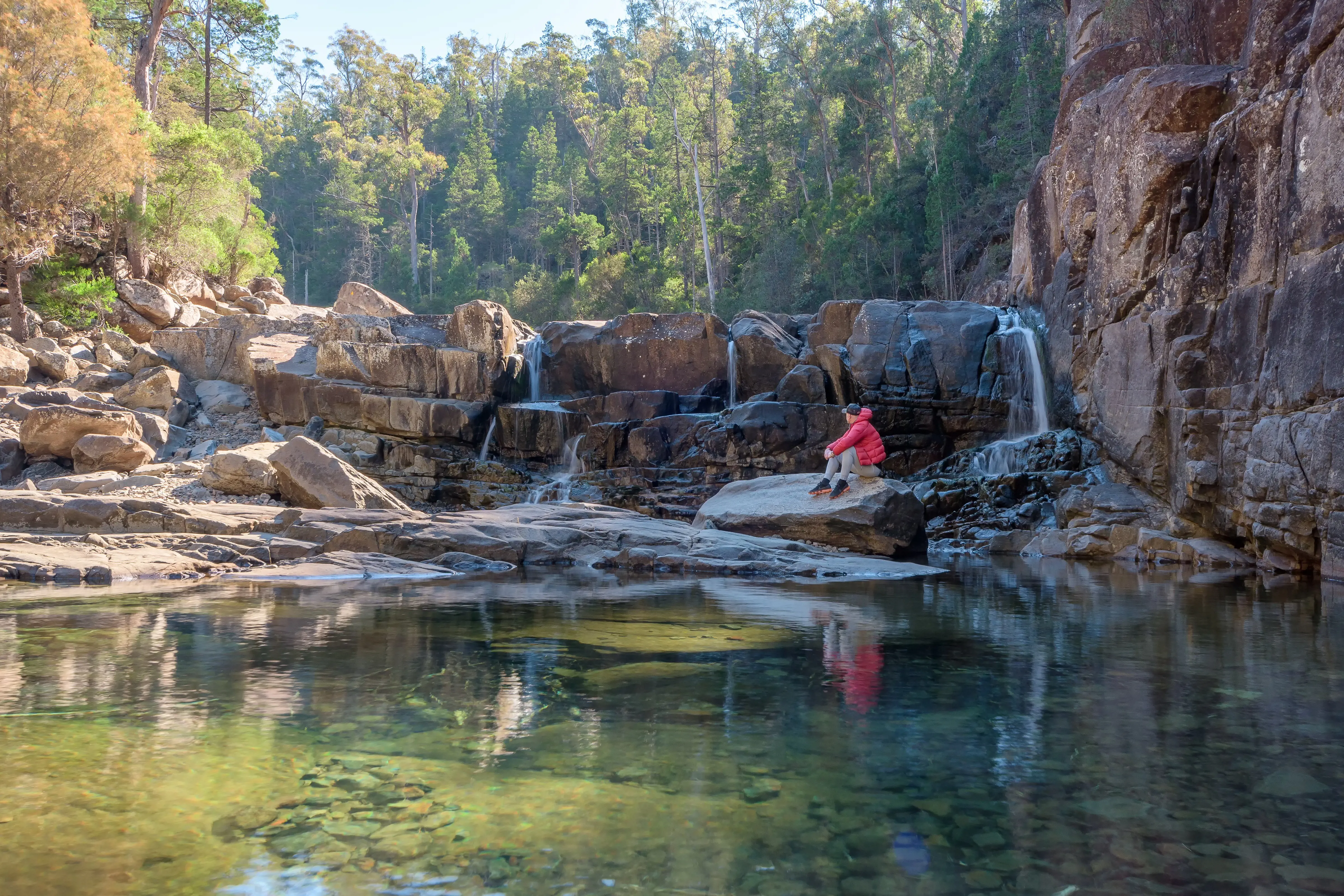
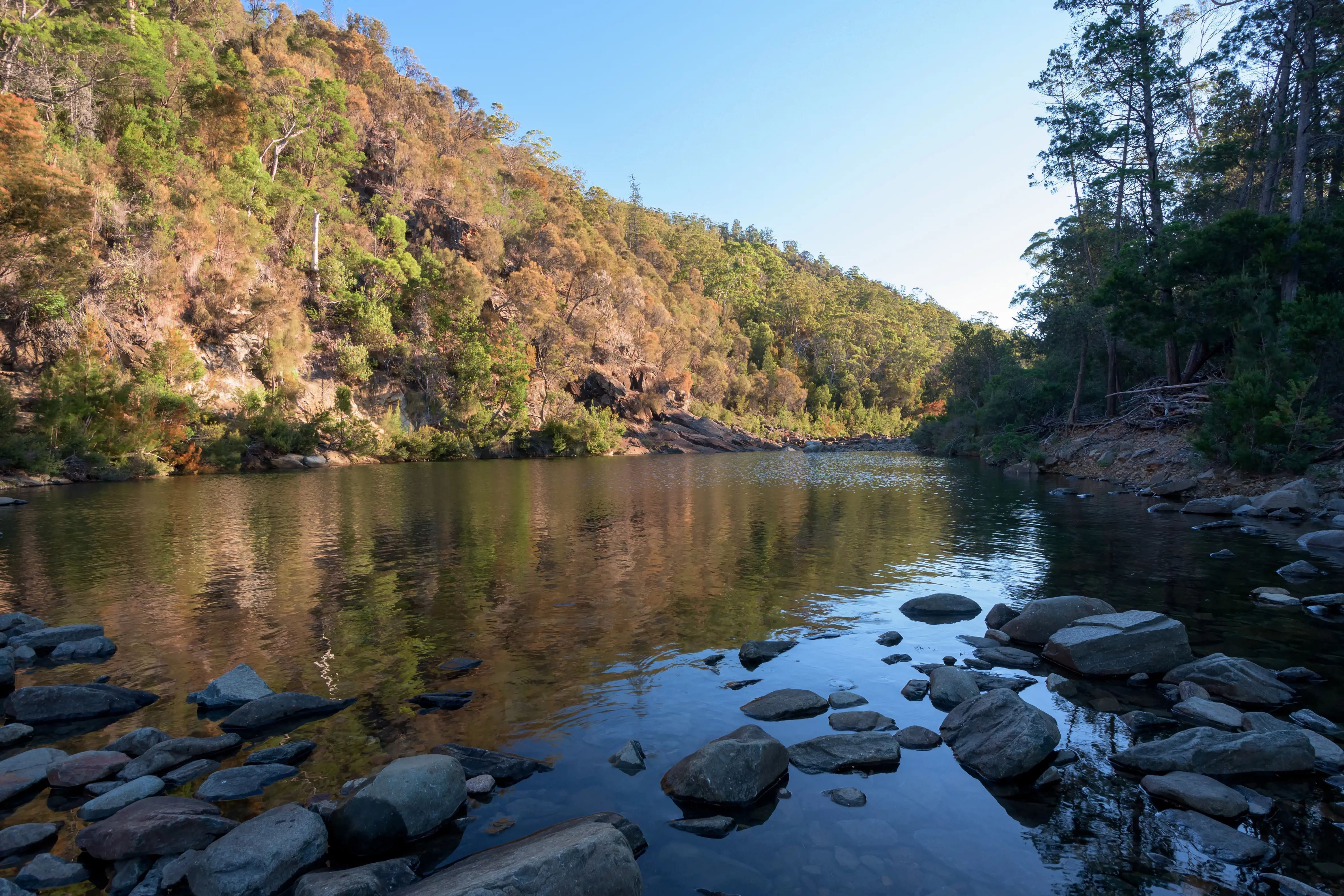
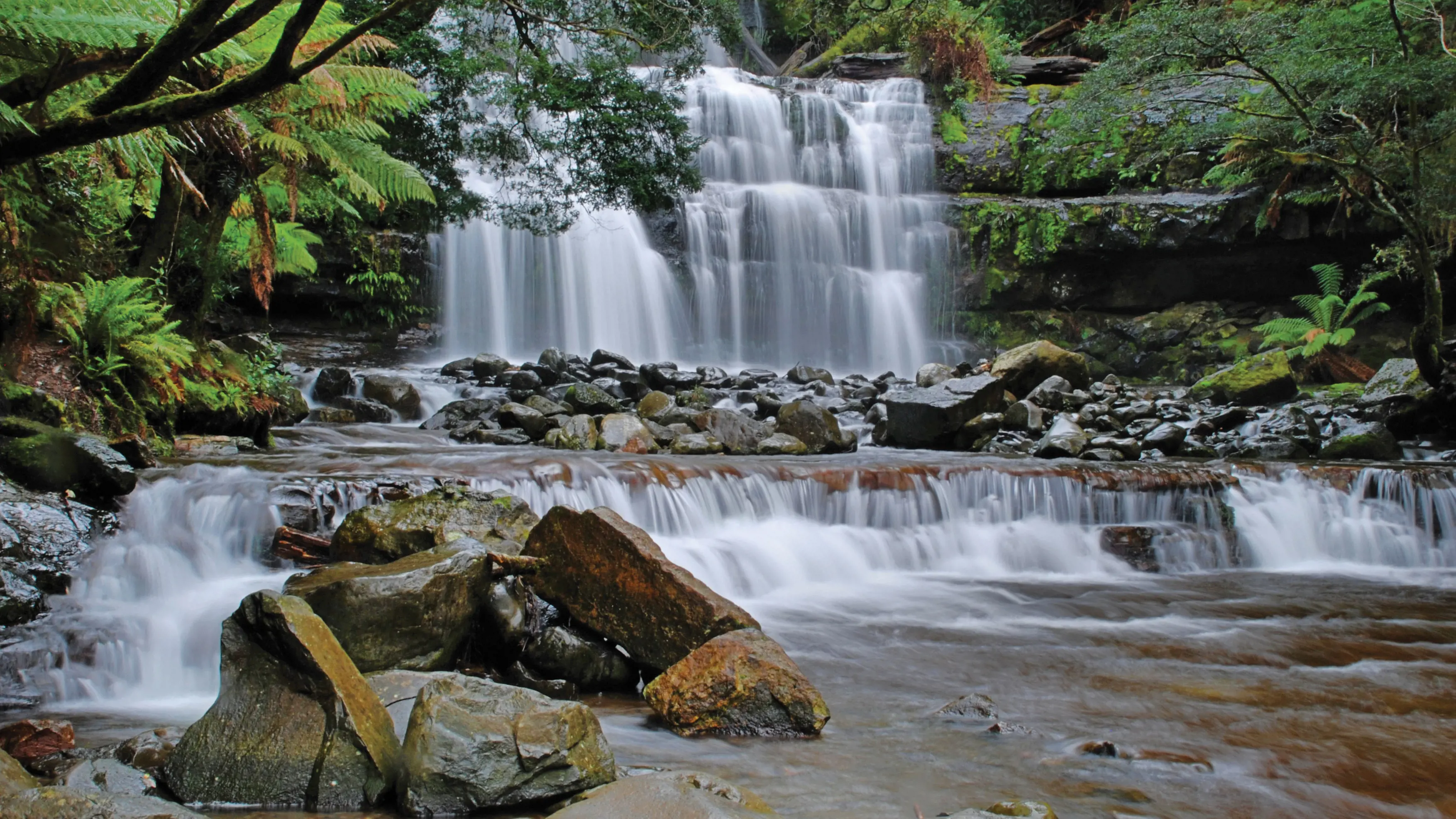
Not far from Freycinet’s fancy coastal scenes, the Apsley River carves its own inland wonder: Apsley Gorge. It’s a walk of just a few minutes to Apsley Waterhole – a great swimming spot – before the trail climbs over a low ridge and descends into the guts of the gorge, slowly rock-hopping its way back through the gorge to the waterhole. Allow 4-5hr for the full loop.
Start and finish: Rosedale Rd, Douglas-Apsley National Park.
Time & distance: 4-5hr return, 7km.
Where: The trailhead is a 2hr 30min drive (190km) north-east of Hobart and a 2hr drive (170km) south-east of Launceston. The gorge is passable only at low water, and shouldn’t be attempted if rain is forecast or if you’re unsteady walking on rocks. A parks pass is required.
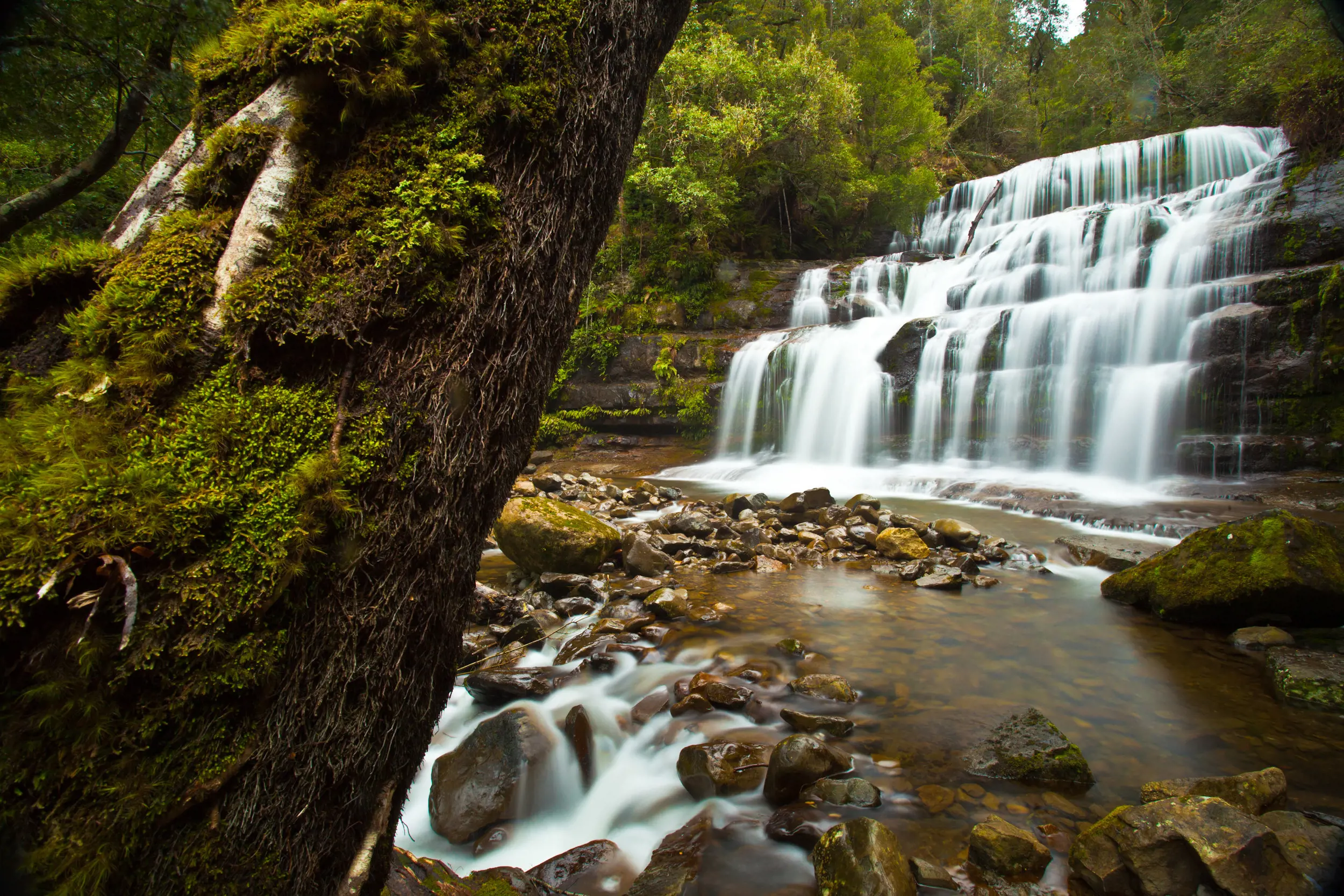
Tasmania’s highest waterfall can be reached only on foot (or mountain bike), with the 3hr return walk to the falls following the course of a former mining tramway beside the Ring River. It’s almost entirely through rainforest, and the track leads right to the base of the 104m-high falls. Add an extra dimension to the walk – and a different angle on the falls – by venturing onto the narrow swing bridge beside the trail’s end.
Start and finish: Williamsford.
Time and distance: 3hr return, 11.5km.
Where: Montezuma Falls are a 3hr 30min (220km) drive south-west of Launceston and a 5hr drive (320km) from Hobart. Heavy metals from early mining days still contaminate some of the waterways along the walk, so don’t drink from any streams.
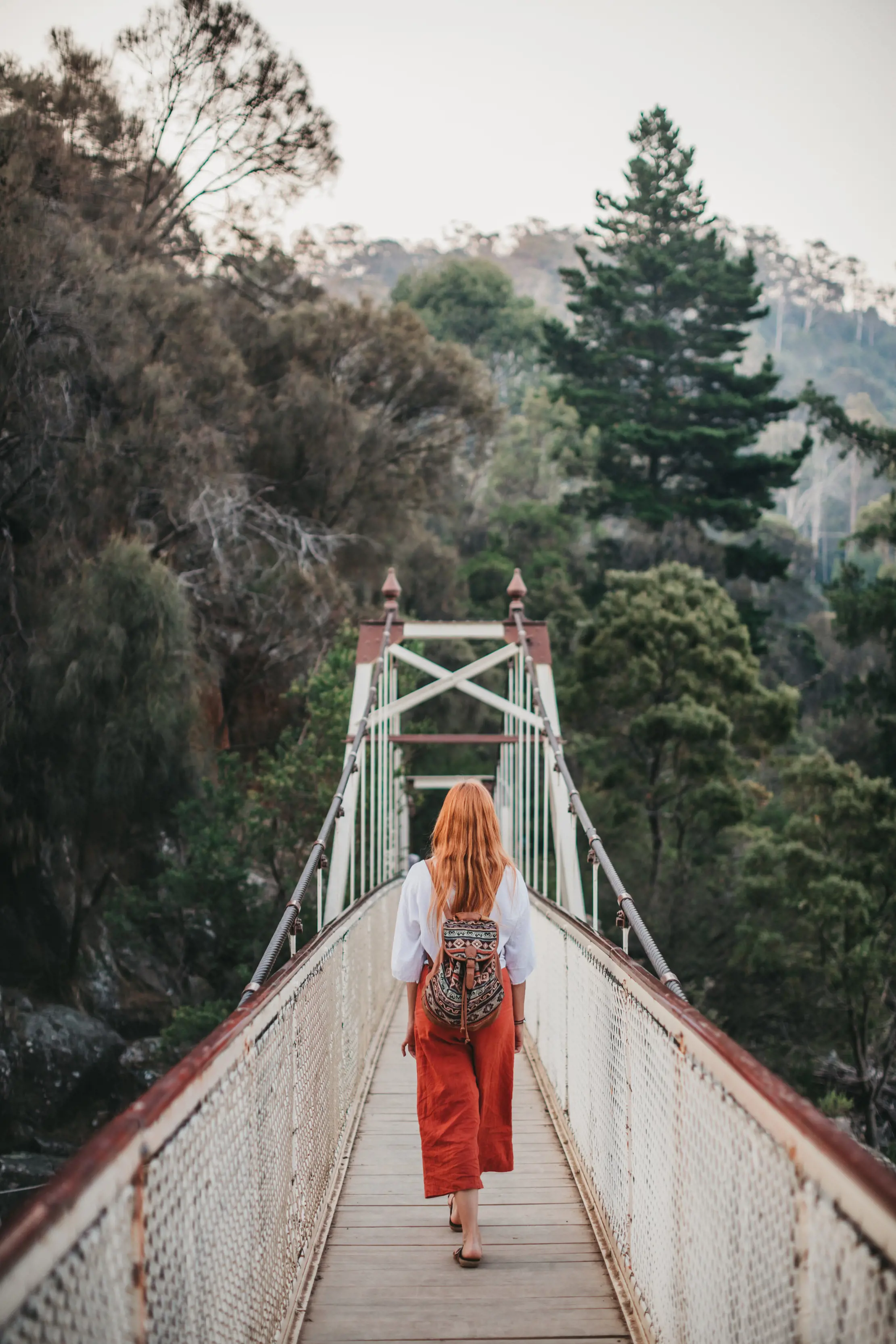
Suspension bridge at Montezuma Falls
Deep in the Takayna / Tarkine rainforest, on the bank of the moodily dark Pieman River, a former gold-mining town named Corinna is the hub for several walks, including the Huon Pine Walk. This 20min trail burrows through the rainforest to an ancient Huon pine tree hanging over the Pieman River. These revered trees, which grow only along waterways on Tasmania’s west coast, are the world’s second-oldest tree species, growing for more than 2000 years.
Start and finish: Corinna.
Time and distance: 20min, 600m
Where: Corinna is a 3hr 30min drive (250km) west of Launceston and a 5hr drive (350km) north-west of Hobart.
One of Tasmania’s most beautiful waterfalls, mossy and marvellous Liffey Falls pours through cool-temperate rainforest on the slopes of the Great Western Tiers. It’s easily reached on a 45min return walk from above the falls, following the Liffey River downstream until it tips over a series of cliffs in a picture-book scene.
Start and finish: Riversdale Rd, Liffey Falls State Reserve.
Time and distance: 45min return, 2km.
Where: The walk is a 70min drive (80km) south-west of Launceston. There’s a picnic ground at the start of the walk.
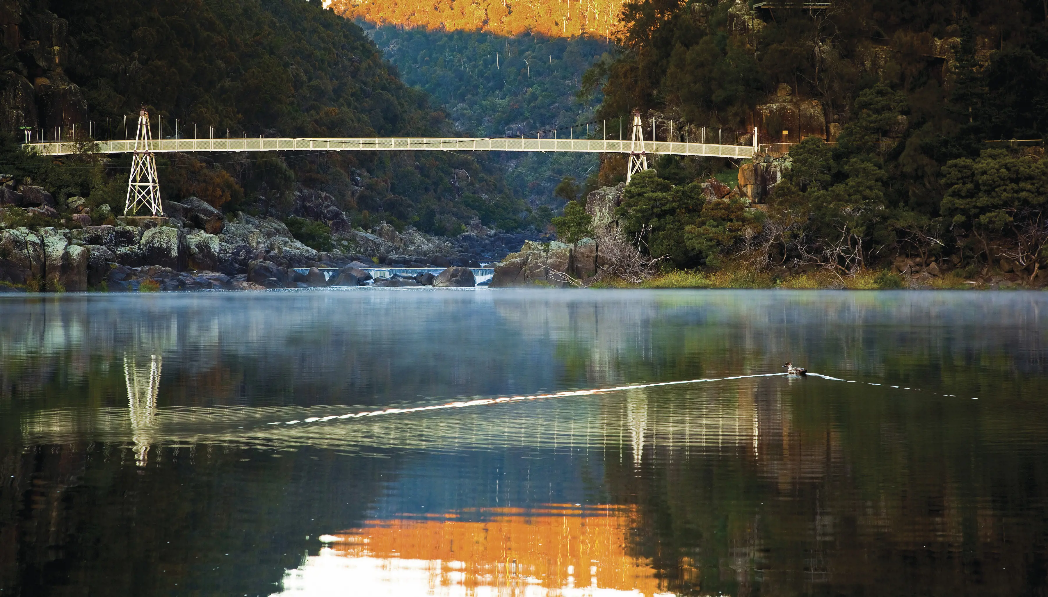
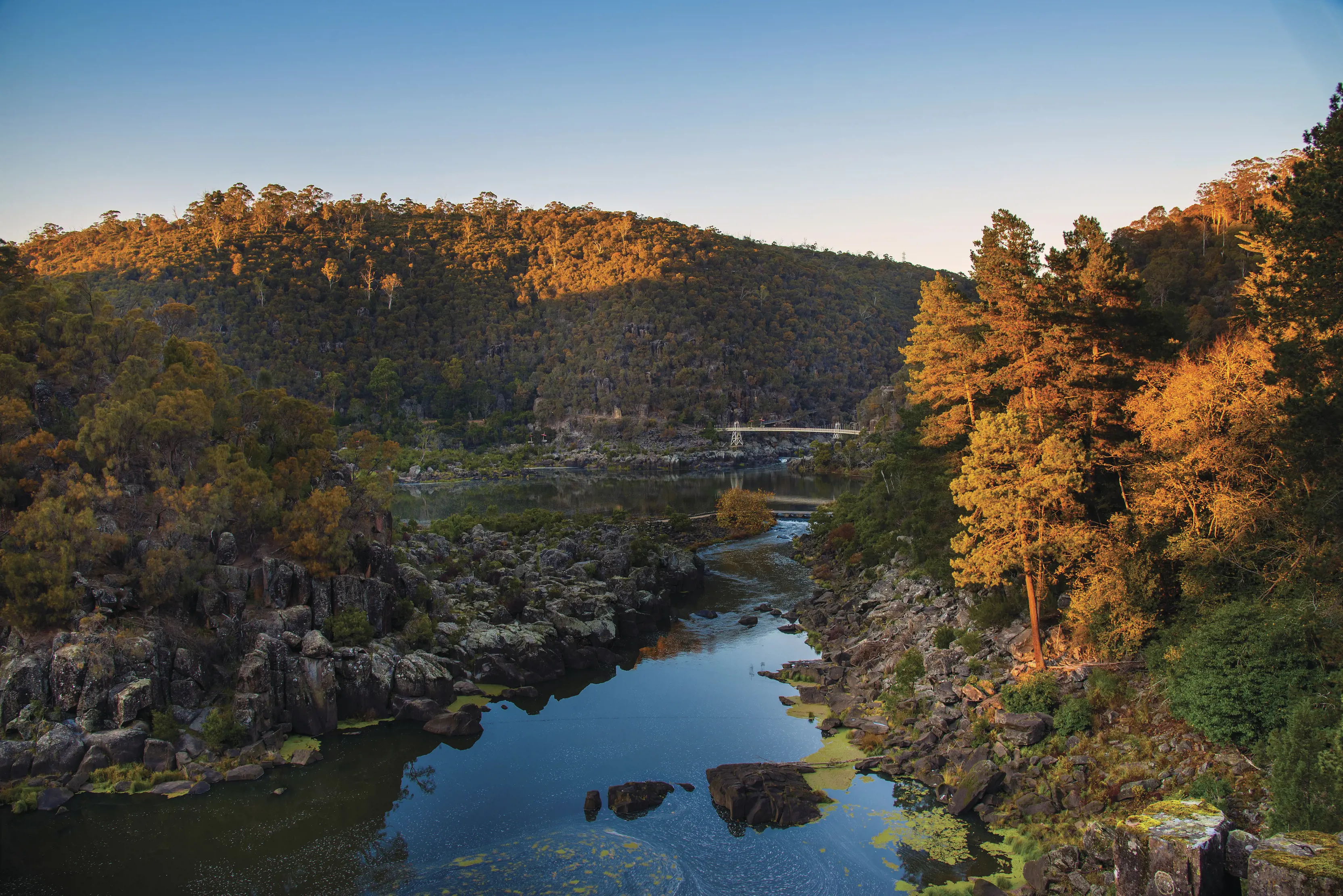
Explore Launceston’s deep Cataract Gorge on a 90min return walk to the former Duck Reach Power Station. Balanced on the steep bank of the North Esk River, beside a long suspension bridge, Duck Reach was one of the world’s first hydroelectricity stations and helped power Launceston for six decades. It’s an unexpected relic inside such a dramatic gorge.
Start and finish: Kings Bridge, West Launceston.
Time and distance: 90min return, 6km.
Where: The walk starts just 1km from Launceston’s CBD, an easy extra stroll in itself.
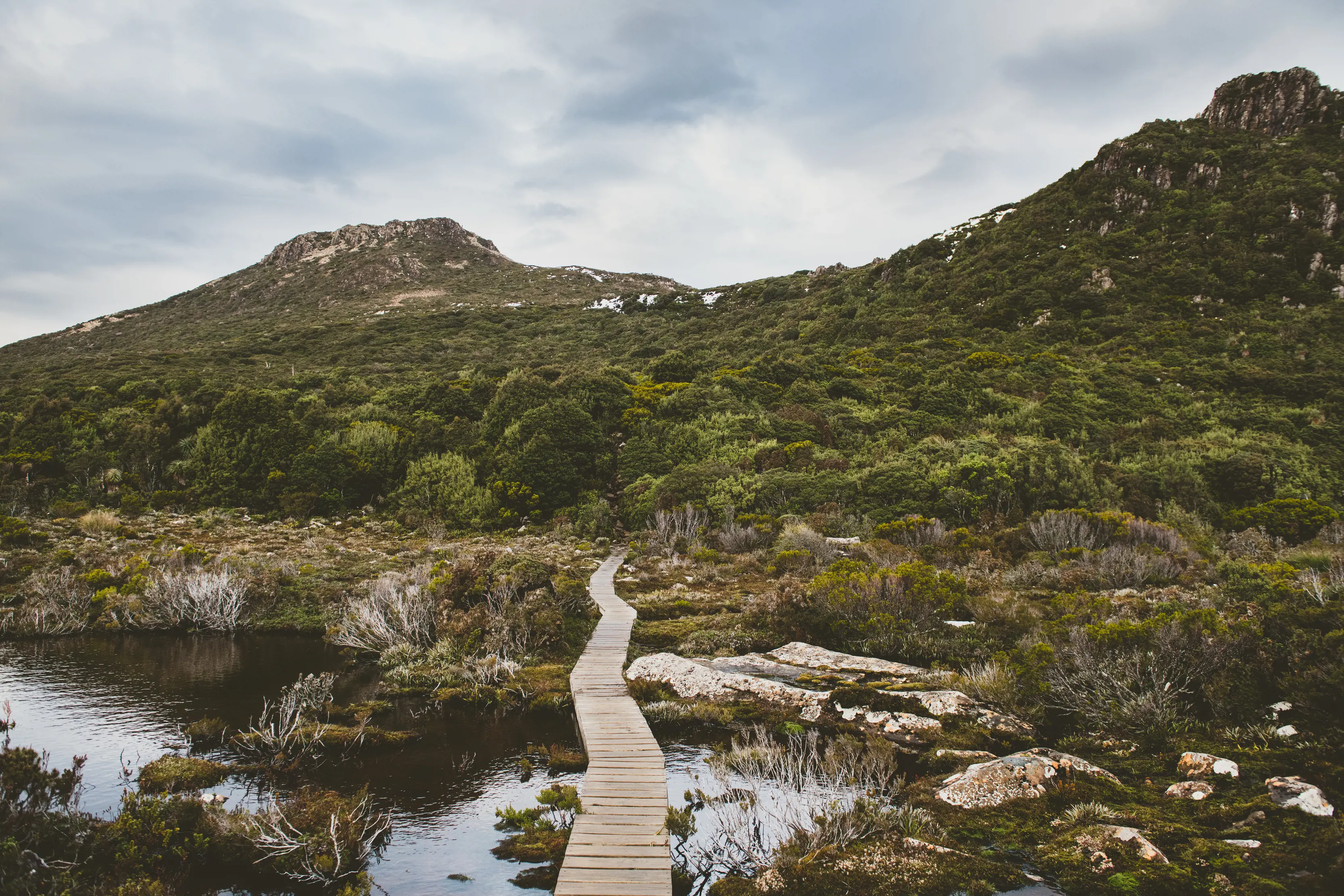
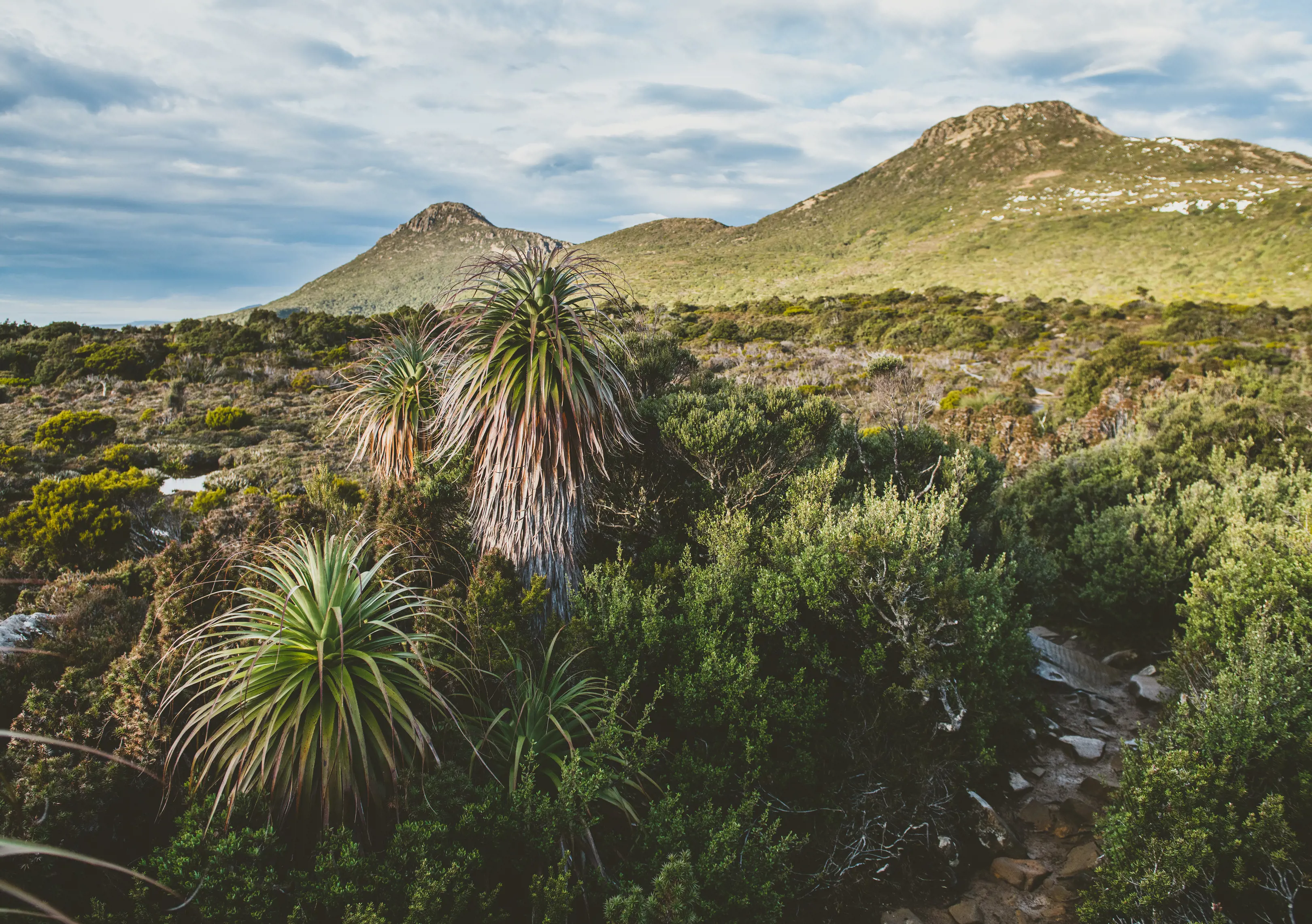
Tasmania has several emblematic alpine plants, but few are as evocative as the pandani. The world’s tallest heath plant grows up to 12m in height, and looks like it could be a Dr Seuss character. This circuit (30-40min) loops around Lake Dobson at the highest road point in Mount Field National Park (1000m above sea level), dipping deep into a tall stand of the shaggy pandani. Scan the lake also for a possible platypus sighting.
Start and finish: Lake Dobson car park, Mount Field National Park.
Time and distance: 30-40min return, 1.5km.
Where: Lake Dobson is a 100min drive (88km) north-west of Hobart. Mountain conditions at this altitude can be severe, so bring plenty of warm clothing. A parks pass is required.